MyTopo
Gurdane Oregon US Topo Map
Couldn't load pickup availability
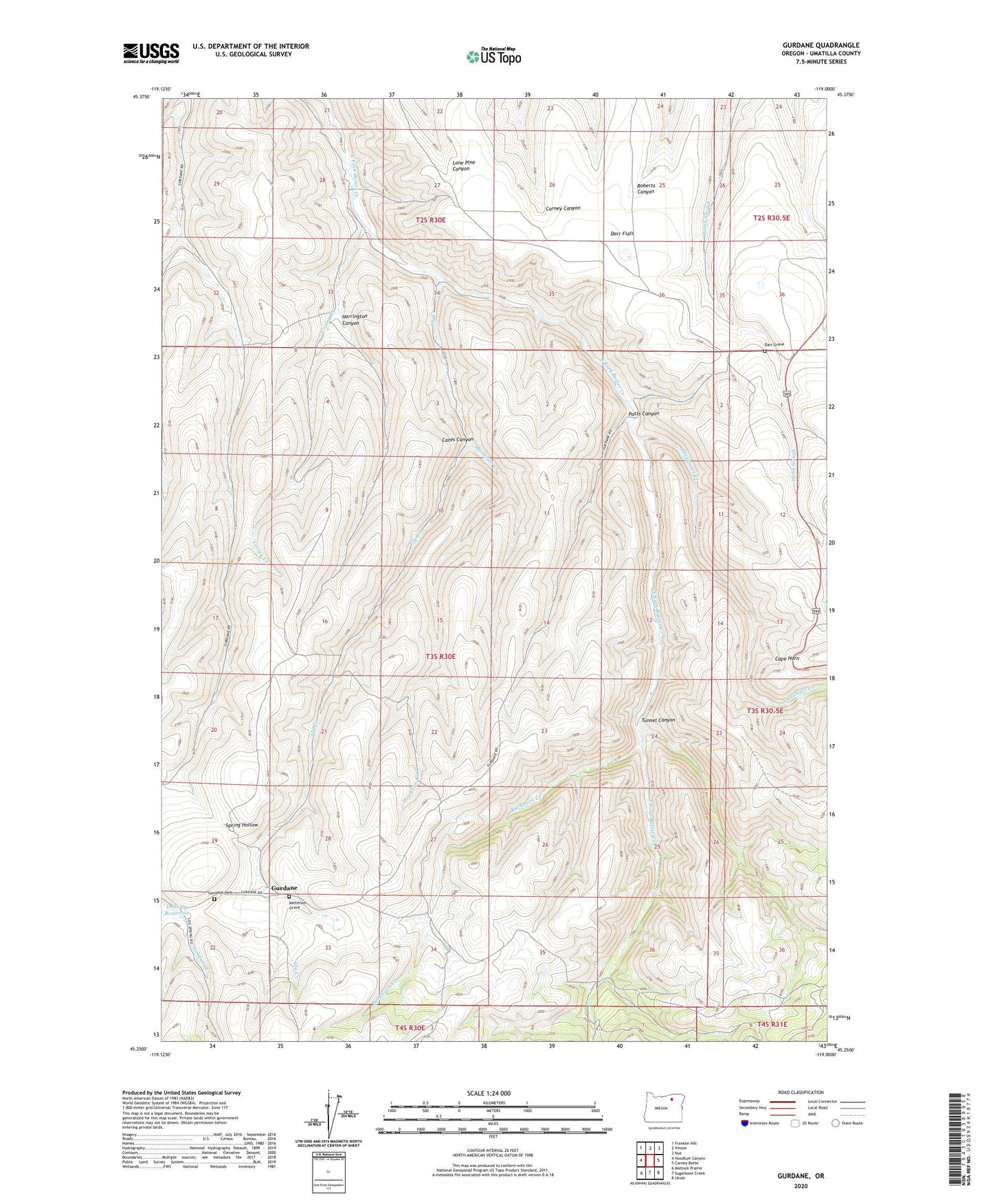
2023 topographic map quadrangle Gurdane in the state of Oregon. Scale: 1:24000. Based on the newly updated USGS 7.5' US Topo map series, this map is in the following counties: Umatilla. The map contains contour data, water features, and other items you are used to seeing on USGS maps, but also has updated roads and other features. This is the next generation of topographic maps. Printed on high-quality waterproof paper with UV fade-resistant inks.
Quads adjacent to this one:
West: Hoodlum Canyon
Northwest: Franklin Hill
North: Vinson
Northeast: Nye
East: Carney Butte
Southeast: Ukiah
South: Sugarbowl Creek
Southwest: Matlock Prairie
This map covers the same area as the classic USGS quad with code o45119c1.
Contains the following named places: Alexander Creek, Buckhorn Creek, Cape Horn, Cates Canyon, Corley Creek, Darr Flats, Darr Grave, Doherty Reservoir, Ely Creek, Gurdane, Gurdane Cemetery, Gurdane Post Office, Harrington Canyon, Monahan Creek, Patterson Grave, Potts Canyon, Ridge Post Office, Tunnel Canyon