MyTopo
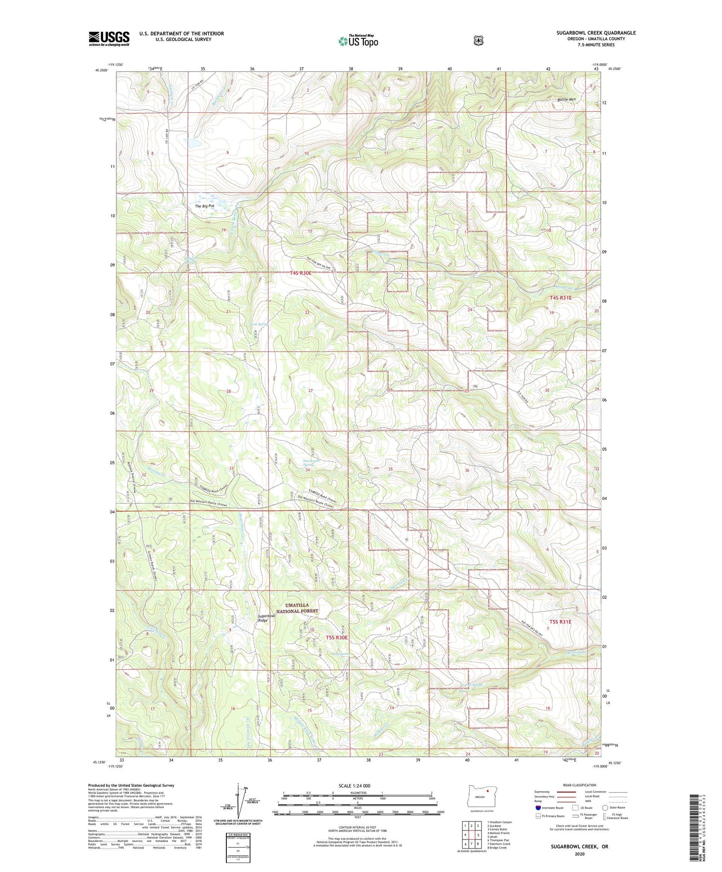
Sugarbowl Creek Oregon US Topo Map
Couldn't load pickup availability
Also explore the Sugarbowl Creek Forest Service Topo of this same quad for updated USFS data
2023 topographic map quadrangle Sugarbowl Creek in the state of Oregon. Scale: 1:24000. Based on the newly updated USGS 7.5' US Topo map series, this map is in the following counties: Umatilla. The map contains contour data, water features, and other items you are used to seeing on USGS maps, but also has updated roads and other features. This is the next generation of topographic maps. Printed on high-quality waterproof paper with UV fade-resistant inks.
Quads adjacent to this one:
West: Matlock Prairie
Northwest: Hoodlum Canyon
North: Gurdane
Northeast: Carney Butte
East: Ukiah
Southeast: Bridge Creek
South: Deerhorn Creek
Southwest: Thompson Flat
This map covers the same area as the classic USGS quad with code o45119b1.
Contains the following named places: Battle Mountain, Forest Spring, Gilman Ranch, Gulliford Spring, Log Spring, Morsay Creek, Sturdevant Spring, Sugarbowl Creek, Sugarbowl Ridge, The Big Pot, Wolf Spring