MyTopo
McCarthy Ridge Oregon US Topo Map
Couldn't load pickup availability
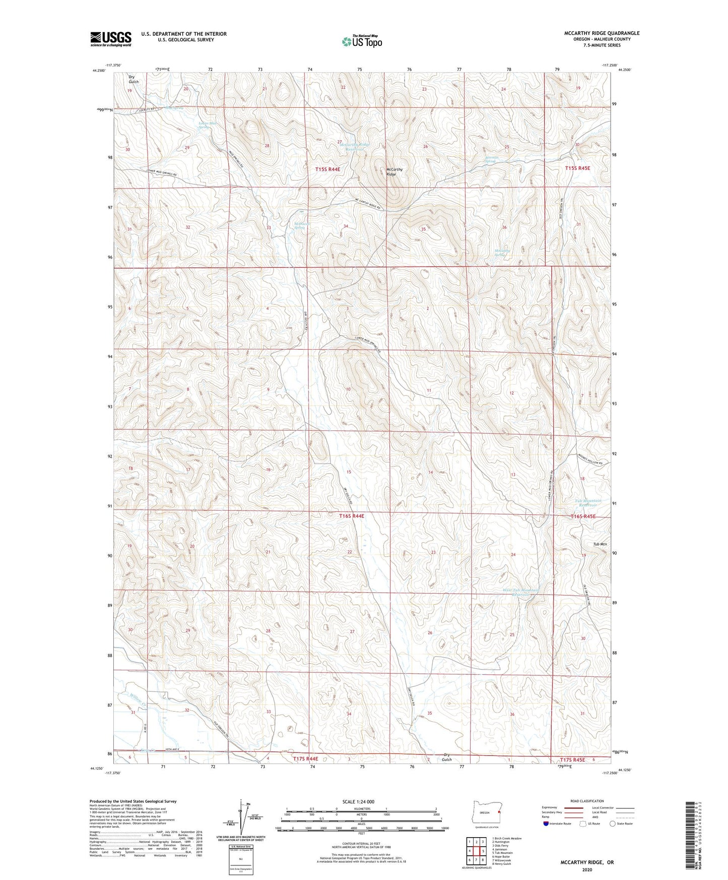
2023 topographic map quadrangle McCarthy Ridge in the state of Oregon. Scale: 1:24000. Based on the newly updated USGS 7.5' US Topo map series, this map is in the following counties: Malheur. The map contains contour data, water features, and other items you are used to seeing on USGS maps, but also has updated roads and other features. This is the next generation of topographic maps. Printed on high-quality waterproof paper with UV fade-resistant inks.
Quads adjacent to this one:
West: Jamieson
Northwest: Birch Creek Meadow
North: Huntington
Northeast: Olds Ferry
East: Tub Mountain
Southeast: Henry Gulch
South: Willowcreek
Southwest: Hope Butte
This map covers the same area as the classic USGS quad with code o44117b3.
Contains the following named places: Beirman Spring, Dry Gulch Reservoir, Kern Creek, Lower Mud Spring, McCarthy Ridge, McCarthy Ridge Reservoir, McCarthy Spring, McDowell Spring, Mud Creek, Mud Spring, Redsull Well, Tub Mountain Reservoir, West Tub Mountain Reservoir, Willow Springs Camp