MyTopo
Tub Mountain Oregon US Topo Map
Couldn't load pickup availability
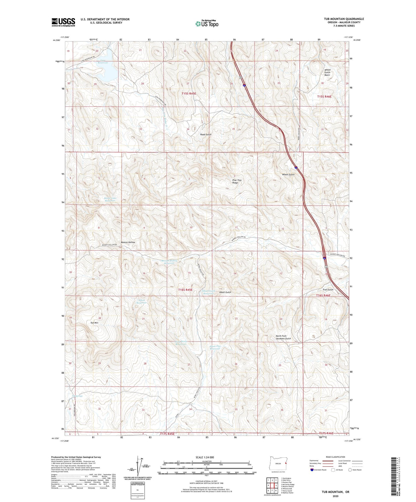
2023 topographic map quadrangle Tub Mountain in the state of Oregon. Scale: 1:24000. Based on the newly updated USGS 7.5' US Topo map series, this map is in the following counties: Malheur. The map contains contour data, water features, and other items you are used to seeing on USGS maps, but also has updated roads and other features. This is the next generation of topographic maps. Printed on high-quality waterproof paper with UV fade-resistant inks.
Quads adjacent to this one:
West: McCarthy Ridge
Northwest: Huntington
North: Olds Ferry
Northeast: Porters Flat
East: Moores Hollow
Southeast: Malheur Butte
South: Henry Gulch
Southwest: Willowcreek
This map covers the same area as the classic USGS quad with code o44117b2.
Contains the following named places: Alkali Flat Reservoir, Alkali Gulch Reservoir, Alkali Reservoir, Bostic Lake Reservoir, Long Drain Reservoir, Love Reservoir, Moores Hollow Dam, Moores Hollow Reservoir, Pine Tree Ridge, Pine Tree Ridge Creek, Trail Gulch, Tub Mountain, Tub Springs, Wheel Gulch Basin