MyTopo
Olds Ferry Idaho US Topo Map
Couldn't load pickup availability
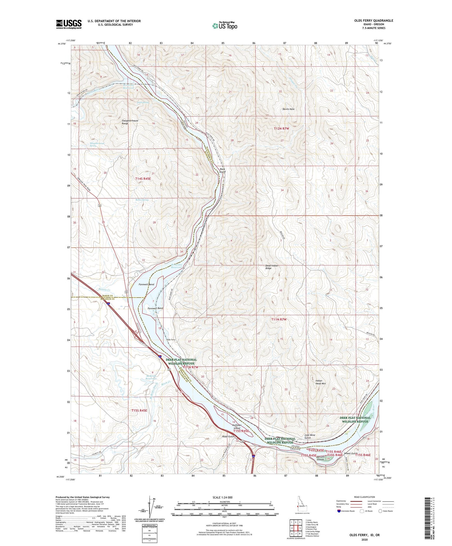
2024 topographic map quadrangle Olds Ferry in the states of Idaho, Oregon. Scale: 1:24000. Based on the newly updated USGS 7.5' US Topo map series, this map is in the following counties: Washington, Malheur, Baker. The map contains contour data, water features, and other items you are used to seeing on USGS maps, but also has updated roads and other features. This is the next generation of topographic maps. Printed on high-quality waterproof paper with UV fade-resistant inks.
Quads adjacent to this one:
West: Huntington
Northwest: Lime
North: Henley Basin
Northeast: Olds Ferry NE
East: Porters Flat
Southeast: Moores Hollow
South: Tub Mountain
Southwest: McCarthy Ridge
Contains the following named places: Benson Creek, Birch Creek, Blakes, Blakes Junction, Burnt River, Chicken Creek, Coal Mine Gulch, Crawford Place, Darrows Islands, Dead Indian Ridge, Devils Hole, Farewell Bend, Farewell Bend Post Office, Farewell Bend State Park, Farewell Bend State Park Boat Ramp, Grouse Creek, Huffman Island, Hush Spring, Indian Head Mountain, McBride Ditch, McBride Reservoir, Nagle, Oasis RV Park Boat Ramp, Olds Ferry, Reiber Spring, Road Gulch, Rock Island, Rock Island Station, Slaughterhouse Range, Slaughterhouse Spring, Wheel Gulch