MyTopo
Henry Gulch Oregon US Topo Map
Couldn't load pickup availability
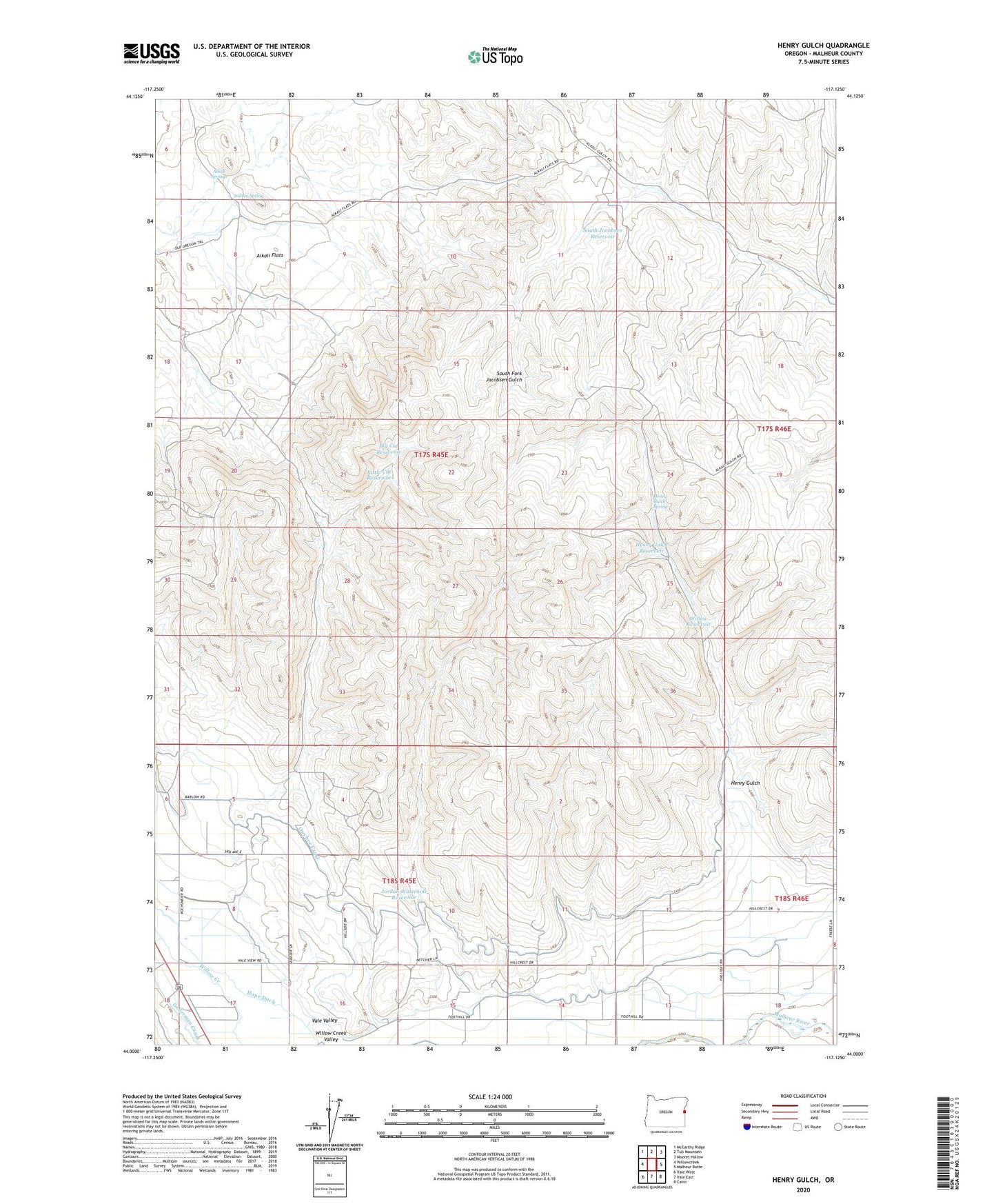
2023 topographic map quadrangle Henry Gulch in the state of Oregon. Scale: 1:24000. Based on the newly updated USGS 7.5' US Topo map series, this map is in the following counties: Malheur. The map contains contour data, water features, and other items you are used to seeing on USGS maps, but also has updated roads and other features. This is the next generation of topographic maps. Printed on high-quality waterproof paper with UV fade-resistant inks.
Quads adjacent to this one:
West: Willowcreek
Northwest: McCarthy Ridge
North: Tub Mountain
Northeast: Moores Hollow
East: Malheur Butte
Southeast: Cairo
South: Vale East
Southwest: Vale West
This map covers the same area as the classic USGS quad with code o44117a2.
Contains the following named places: Alkali Flats, Alkali Springs, Big Cut Reservoir, Channel Reservoir, Henry Gulch, Henry Gulch Reservoir, Henry Gulch Spring, Hope Ditch, Indian Spring, Jordan Waterhole Reservoir, Little Cut Reservoir, Owyhee Canal, South Jacobsen Reservoir, Three Forks Reservoir, Willow Creek Valley, Willow Reservoir