MyTopo
Rock Creek Oregon US Topo Map
Couldn't load pickup availability
Also explore the Rock Creek Forest Service Topo of this same quad for updated USFS data
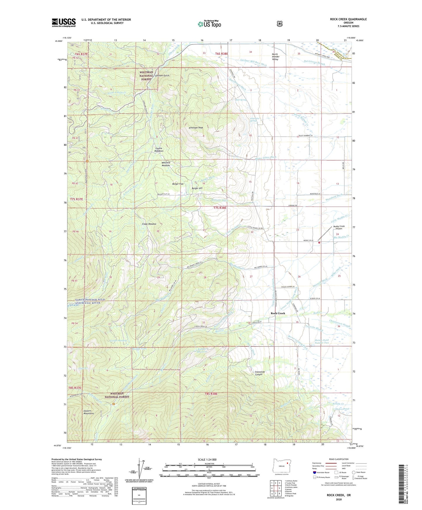
2024 topographic map quadrangle Rock Creek in the state of Oregon. Scale: 1:24000. Based on the newly updated USGS 7.5' US Topo map series, this map is in the following counties: Baker, Union. The map contains contour data, water features, and other items you are used to seeing on USGS maps, but also has updated roads and other features. This is the next generation of topographic maps. Printed on high-quality waterproof paper with UV fade-resistant inks.
Quads adjacent to this one:
West: Anthony Lakes
Northwest: Anthony Butte
North: Tucker Flat
Northeast: North Powder
East: Haines
Southeast: Wingville
South: Elkhorn Peak
Southwest: Bourne
This map covers the same area as the classic USGS quad with code o44118h1.
Contains the following named places: Antelope Peak, Antone Creek, Badsky Pond, Blume Zilkey Ditch, Brown Loennig Ditch, Bulger Ditch, Bulger Flat, Bulger Hill, Clapp Meadow, Clear Creek, Dutch Flat Creek, Dutch Flat Creek Trailhead, Fannie Meadows, Fisher Hot Springs, Ford Ingram Ditch, Gardner Mill Race Ditch, Gorham Gulch, Haines Fire Protection District Muddy Creek Road, Haines Pond Number Two, Hart Spring, Hutchinson Ditch, Jimmy Creek, Killamacue Creek, Killamacue Trailhead, Lawrence Creek, Little Antone Creek, Locken Meadow, Lower Fisher Long Ditch, Mansfield Ditch, Marble Creek, Maxwell Ditch, Miller Ditch, Mount Carmel, Muddy Creek Airport, Muddy Creek School, Penstock Olsen Ditch, Powers Ditch, Rock Creek, Rock Creek Powerplant, Rock Creek Reservoir, Rockcreek Post Office, Rocky Ford Campground, Sackos Pond, Snowslide Canyon, Sohmer Creek, Upper Fisher Long Ditch, Warfield Meadow, Wilcox Ditch, Williams Ditch, Wingville-Haines Division, Yankey Sawmill, ZIP Code: 97833