MyTopo
Cline Falls Oregon US Topo Map
Couldn't load pickup availability
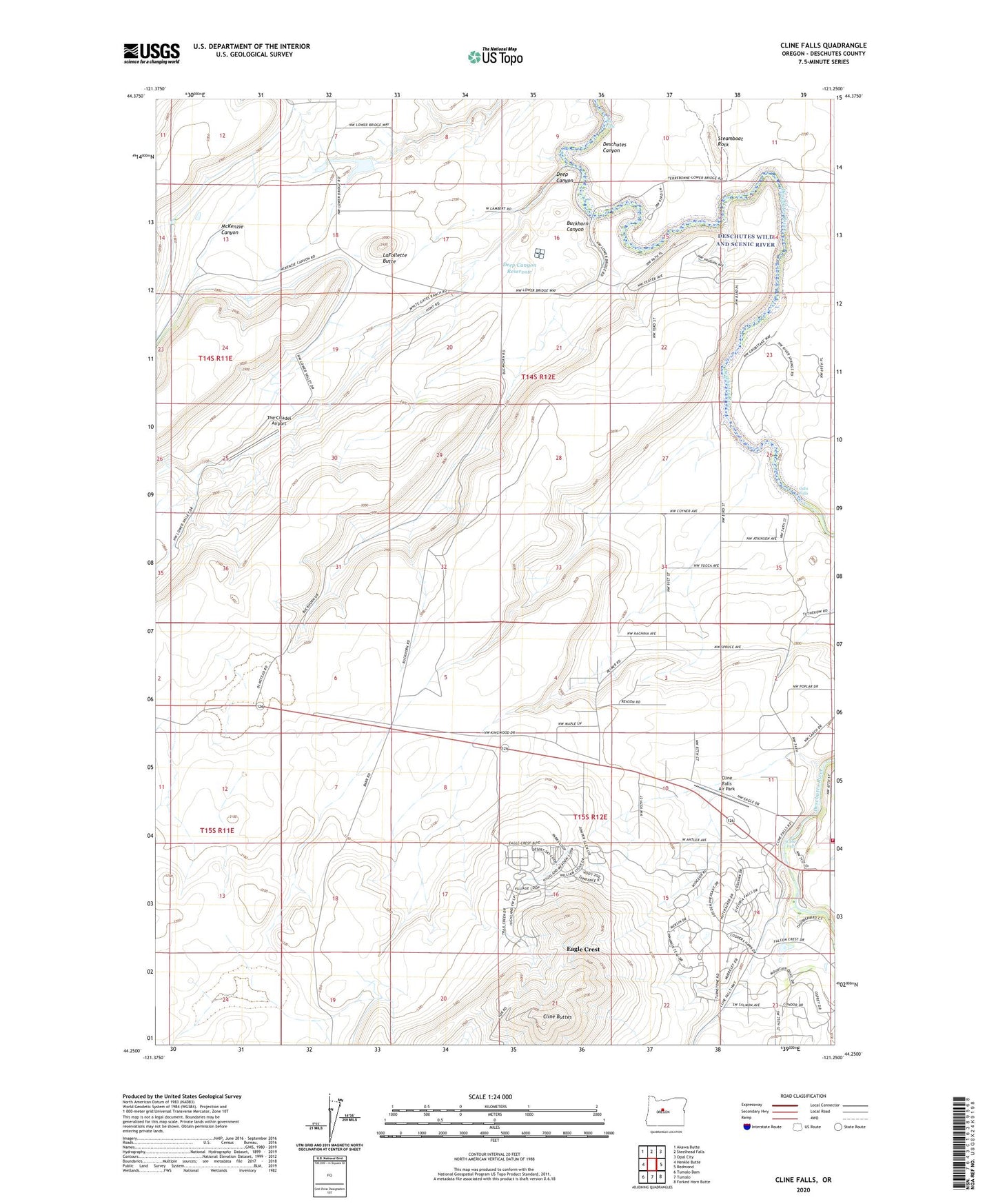
2023 topographic map quadrangle Cline Falls in the state of Oregon. Scale: 1:24000. Based on the newly updated USGS 7.5' US Topo map series, this map is in the following counties: Deschutes. The map contains contour data, water features, and other items you are used to seeing on USGS maps, but also has updated roads and other features. This is the next generation of topographic maps. Printed on high-quality waterproof paper with UV fade-resistant inks.
Quads adjacent to this one:
West: Henkle Butte
Northwest: Akawa Butte
North: Steelhead Falls
Northeast: Opal City
East: Redmond
Southeast: Forked Horn Butte
South: Tumalo
Southwest: Tumalo Dam
This map covers the same area as the classic USGS quad with code o44121c3.
Contains the following named places: Big Falls, Buckhorn Canyon, Cline Buttes, Cline Falls, Cline Falls Air Park, Cline Falls Post Office, Cline Falls State Park, Deep Canyon, Deep Canyon Dam, Deep Canyon Reservoir, Diatomite Mine Headquarters, Eagle Crest Census Designated Place, LaFollette Butte, Lower Bridge, Lower Bridge Post Office, McKenzie Canyon, Odin Falls, Oremite Mine, Redmond Fire and Rescue Station 404, Steamboat Rock, The Citadel Airport, Tumalo Division