MyTopo
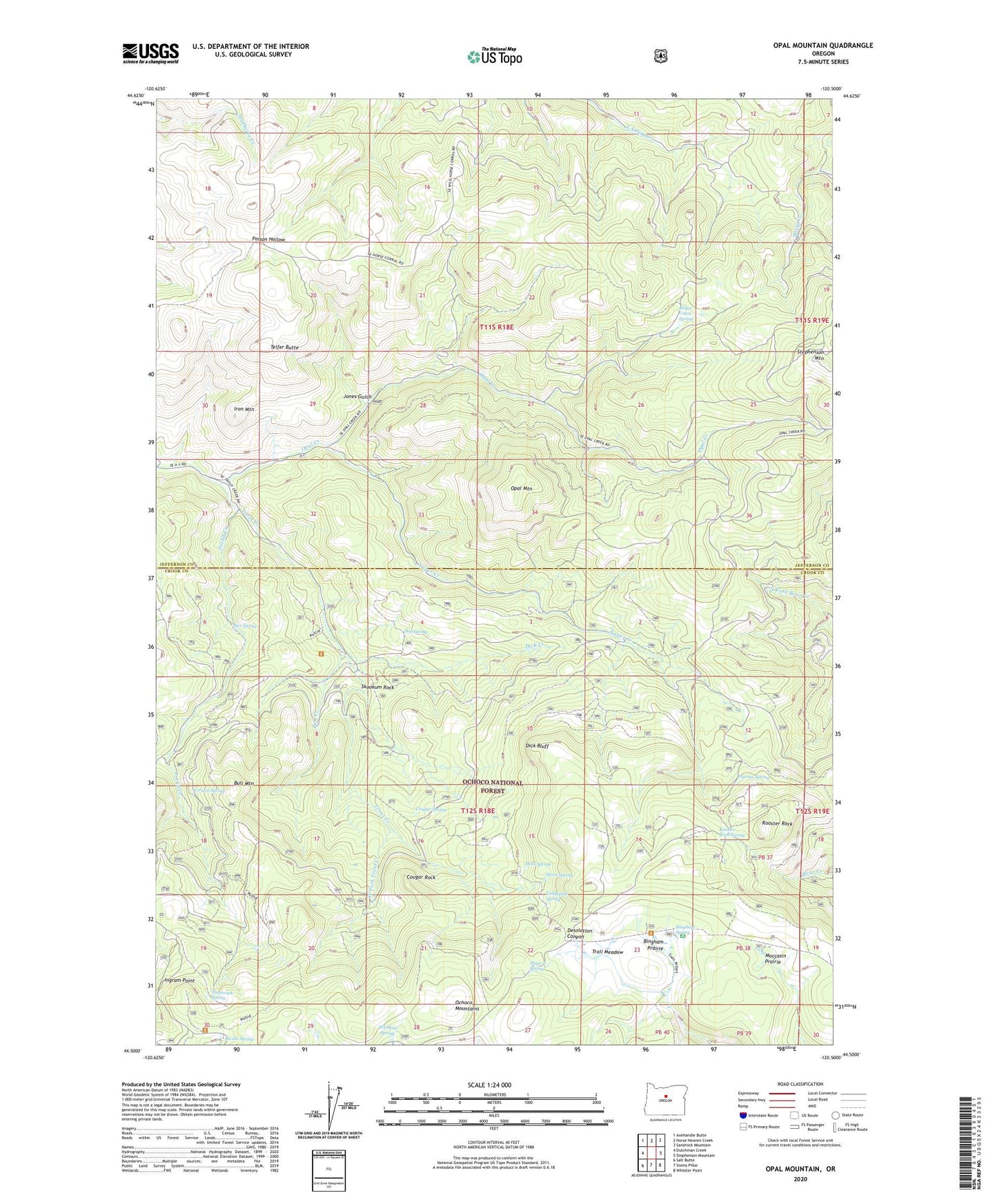
Opal Mountain Oregon US Topo Map
Couldn't load pickup availability
2020 topographic map quadrangle Opal Mountain in the state of Oregon. Scale: 1:24000. Based on the newly updated USGS 7.5' US Topo map series, this map is in the following counties: Jefferson, Crook. The map contains contour data, water features, and other items you are used to seeing on USGS maps, but also has updated roads and other features. This is the next generation of topographic maps. Printed on high-quality waterproof paper with UV fade-resistant inks.
Quads adjacent to this one:
West: Dutchman Creek
Northwest: Axehandle Butte
North: Horse Heaven Creek
Northeast: Sandrock Mountain
East: Stephenson Mountain
Southeast: Whistler Point
South: Steins Pillar
Southwest: Salt Butte
Contains the following named places: Auger Creek, Bingham Prairie, Bingham Prairie Campground, Bingham Spring, Box Spring, Bull Creek, Bull Mountain, Corwin Spring, Cougar Rock, Cougar Spring, Dick Bluff, Dick Creek, Divide Cabin, Divide Spring, Doe Spring, Ingram Point, Ingram Spring, Iron Mountain, Jones Gulch, Keller Cabin Spring, Lodgepole Spring, Moccasin Prairie, Opal Creek, Opal Mountain, Potlid Creek, Rooster Rock, Rooster Rock Spring, Roundup Grounds, Skookum Rock, Skull Spring, Stove Spring, Symons Wood Camp, Tamarack Spring, Telfer Butte, Three C Spring, Trail Cabin, Trail Meadow, West Fork Trout Creek, Whiskey Spring