MyTopo
Dutchman Creek Oregon US Topo Map
Couldn't load pickup availability
Also explore the Dutchman Creek Forest Service Topo of this same quad for updated USFS data
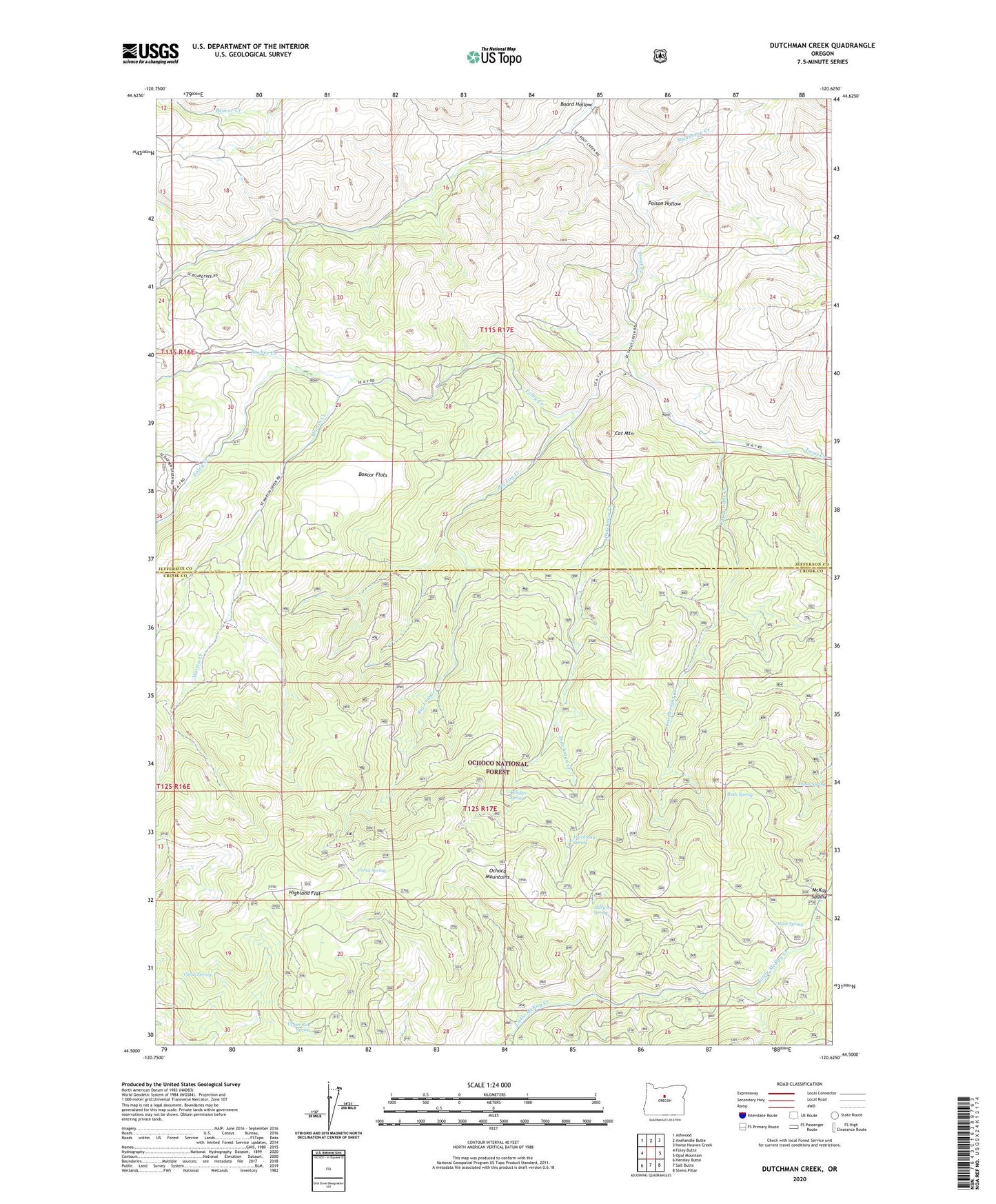
2023 topographic map quadrangle Dutchman Creek in the state of Oregon. Scale: 1:24000. Based on the newly updated USGS 7.5' US Topo map series, this map is in the following counties: Jefferson, Crook. The map contains contour data, water features, and other items you are used to seeing on USGS maps, but also has updated roads and other features. This is the next generation of topographic maps. Printed on high-quality waterproof paper with UV fade-resistant inks.
Quads adjacent to this one:
West: Foley Butte
Northwest: Ashwood
North: Axehandle Butte
Northeast: Horse Heaven Creek
East: Opal Mountain
Southeast: Steins Pillar
South: Salt Butte
Southwest: Hensley Butte
This map covers the same area as the classic USGS quad with code o44120e6.
Contains the following named places: Alder Spring, Aldrich Spring, Angus Spring, Barber Creek, Big Log Creek, Board Hollow, Boxcar Flats, Cartwright Creek, Cat Mountain, Curtis Spring, Cyrus Spring, Dutchman Creek, Dutchman Spring, Foley Creek, Highland Flat, Hunt Spring, Martin Creek, McKay Saddle, Ochillee Spring, Poison Hollow, Ruth Spring, Studhorse Creek, Trout Creek Cow Camp, Upper Ray Spring