MyTopo
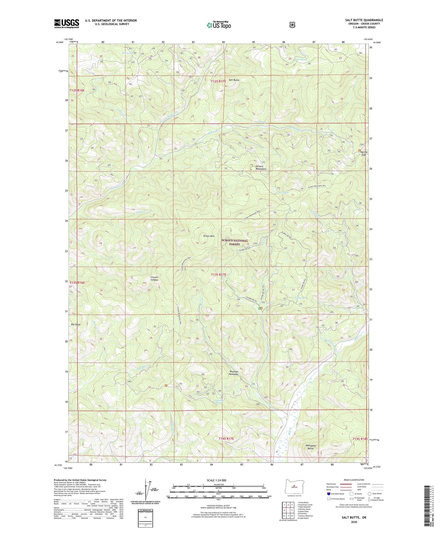
Salt Butte Oregon US Topo Map
Couldn't load pickup availability
Also explore the Salt Butte Forest Service Topo of this same quad for updated USFS data
2023 topographic map quadrangle Salt Butte in the state of Oregon. Scale: 1:24000. Based on the newly updated USGS 7.5' US Topo map series, this map is in the following counties: Crook. The map contains contour data, water features, and other items you are used to seeing on USGS maps, but also has updated roads and other features. This is the next generation of topographic maps. Printed on high-quality waterproof paper with UV fade-resistant inks.
Quads adjacent to this one:
West: Hensley Butte
Northwest: Foley Butte
North: Dutchman Creek
Northeast: Opal Mountain
East: Steins Pillar
Southeast: Cadle Butte
South: Ochoco Reservoir
Southwest: Prineville
This map covers the same area as the classic USGS quad with code o44120d6.
Contains the following named places: A-Y Spring, Beetle Spring, Big Table, Brennan Palisades, Burn Creek, Cabin Guard Station, Cow Camp Cabin, Deer Creek, Dry Creek, Evans Creek, Green Mountain, Green Spring, Harvey Gap, Horse Spring, Kidnap Spring, Little McKay Creek, Mahogany Butte, McKay Creek Forest Camp, Poppy Creek, Ray Spring, Salt Butte, Schoolhouse Creek, Slayton Corral, Strickland Spring, Whitetail Spring