MyTopo
Palomino Buttes Oregon US Topo Map
Couldn't load pickup availability
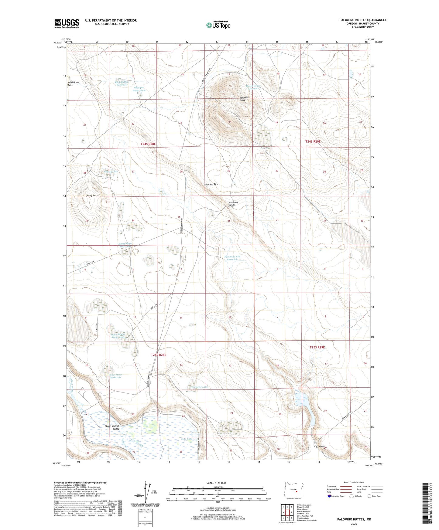
2023 topographic map quadrangle Palomino Buttes in the state of Oregon. Scale: 1:24000. Based on the newly updated USGS 7.5' US Topo map series, this map is in the following counties: Harney. The map contains contour data, water features, and other items you are used to seeing on USGS maps, but also has updated roads and other features. This is the next generation of topographic maps. Printed on high-quality waterproof paper with UV fade-resistant inks.
Quads adjacent to this one:
West: Moon Reservoir
Northwest: Oakerman Lakes
North: Sage Hen Hill
Northeast: Burns Butte
East: Weaver Lake
Southeast: Northwest Harney Lake
South: Stinking Lake
Southwest: Iron Mountain Flat
This map covers the same area as the classic USGS quad with code o43119d3.
Contains the following named places: Bunch Grass Reservoir, Chain Lake, Cote Grade, Cote Lake, Cote Slough, Fay Canyon, Fay Canyon Dam, Fay Canyon Reservoir, Ferry Grade, Grassy Butte, Grassy Butte Reservoir, Grassy Lake, Lone Rabbit Water Hole, Obiaque Water Hole, Palomino Buttes, Palomino Grade, Palomino Lake, Palomino Rim, Palomino Rim Reservoir, Rock Bottom Reservoir, Snow Storm Reservoir, Umbrite Lake, Wild Horse Lake