MyTopo
Stinking Lake Oregon US Topo Map
Couldn't load pickup availability
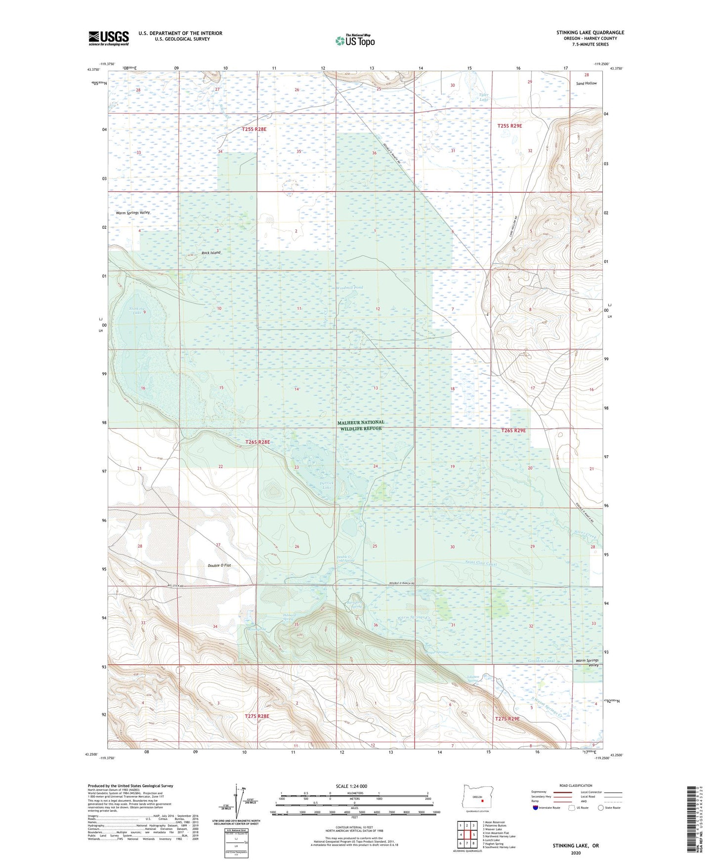
2024 topographic map quadrangle Stinking Lake in the state of Oregon. Scale: 1:24000. Based on the newly updated USGS 7.5' US Topo map series, this map is in the following counties: Harney. The map contains contour data, water features, and other items you are used to seeing on USGS maps, but also has updated roads and other features. This is the next generation of topographic maps. Printed on high-quality waterproof paper with UV fade-resistant inks.
Quads adjacent to this one:
West: Iron Mountain Flat
Northwest: Moon Reservoir
North: Palomino Buttes
Northeast: Weaver Lake
East: Northwest Harney Lake
Southeast: Southwest Harney Lake
South: Hughet Spring
Southwest: Lunch Lake
This map covers the same area as the classic USGS quad with code o43119c3.
Contains the following named places: Barnyard Spring, Basque Spring, Derrick Lake, Double O Cold Spring, Double O Elementary School, Double O Flat, Double O Station, Hibbard Spring, Johnson Spring, Kennedy Post Office, Obiaque Place, Old Tyler Place, Rock Island, Ross Spring, Stinking Lake, Tyler Lake, Windmill Pond