MyTopo
Weaver Lake Oregon US Topo Map
Couldn't load pickup availability
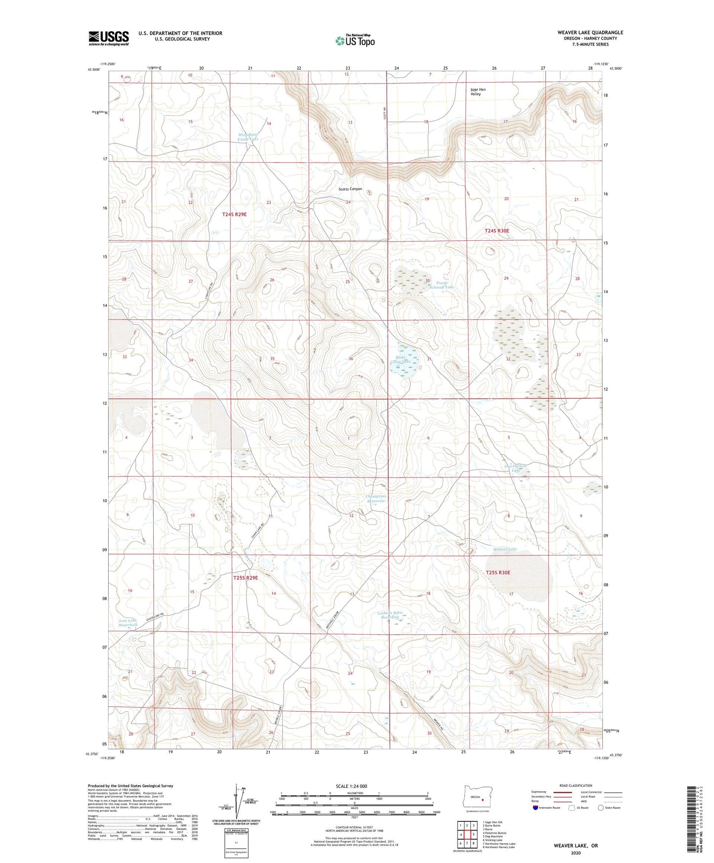
2023 topographic map quadrangle Weaver Lake in the state of Oregon. Scale: 1:24000. Based on the newly updated USGS 7.5' US Topo map series, this map is in the following counties: Harney. The map contains contour data, water features, and other items you are used to seeing on USGS maps, but also has updated roads and other features. This is the next generation of topographic maps. Printed on high-quality waterproof paper with UV fade-resistant inks.
Quads adjacent to this one:
West: Palomino Buttes
Northwest: Sage Hen Hill
North: Burns Butte
Northeast: Burns
East: Dog Mountain
Southeast: Northeast Harney Lake
South: Northwest Harney Lake
Southwest: Stinking Lake
This map covers the same area as the classic USGS quad with code o43119d2.
Contains the following named places: Albert Lake, Batts Camp Lake, Cheatgrass Reservoir, East Chain Lake, Frank Schmidt Lake, Lookout Butte Reservoir, Lost Lake Waterhole, One O'Clock Lake, Sage Hen Valley, Scotts Canyon, South Chain Lake, Weaver Lake, West Batts Camp Lake, West Chain Lake, ZIP Code: 97738