MyTopo
Northwest Harney Lake Oregon US Topo Map
Couldn't load pickup availability
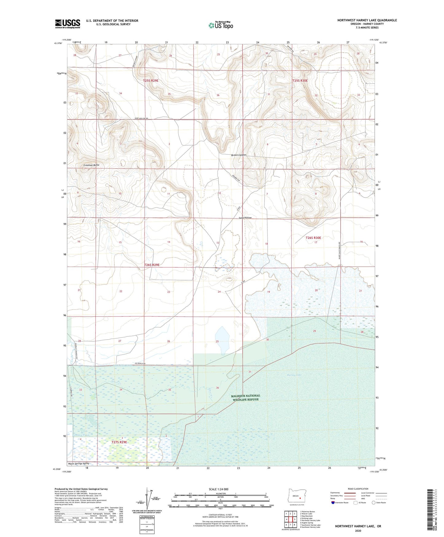
2023 topographic map quadrangle Northwest Harney Lake in the state of Oregon. Scale: 1:24000. Based on the newly updated USGS 7.5' US Topo map series, this map is in the following counties: Harney. The map contains contour data, water features, and other items you are used to seeing on USGS maps, but also has updated roads and other features. This is the next generation of topographic maps. Printed on high-quality waterproof paper with UV fade-resistant inks.
Quads adjacent to this one:
West: Stinking Lake
Northwest: Palomino Buttes
North: Weaver Lake
Northeast: Dog Mountain
East: Northeast Harney Lake
Southeast: Southeast Harney Lake
South: Southwest Harney Lake
Southwest: Hughet Spring
This map covers the same area as the classic USGS quad with code o43119c2.
Contains the following named places: Beshell Grade, Brown Canyon, Freeman Butte, Goulden Canal, Hughet Well, Reed Landing Strip, Saint Clair Canal, Sand Hollow, Silver Creek, South Warm Springs Creek, Warm Springs Creek