MyTopo
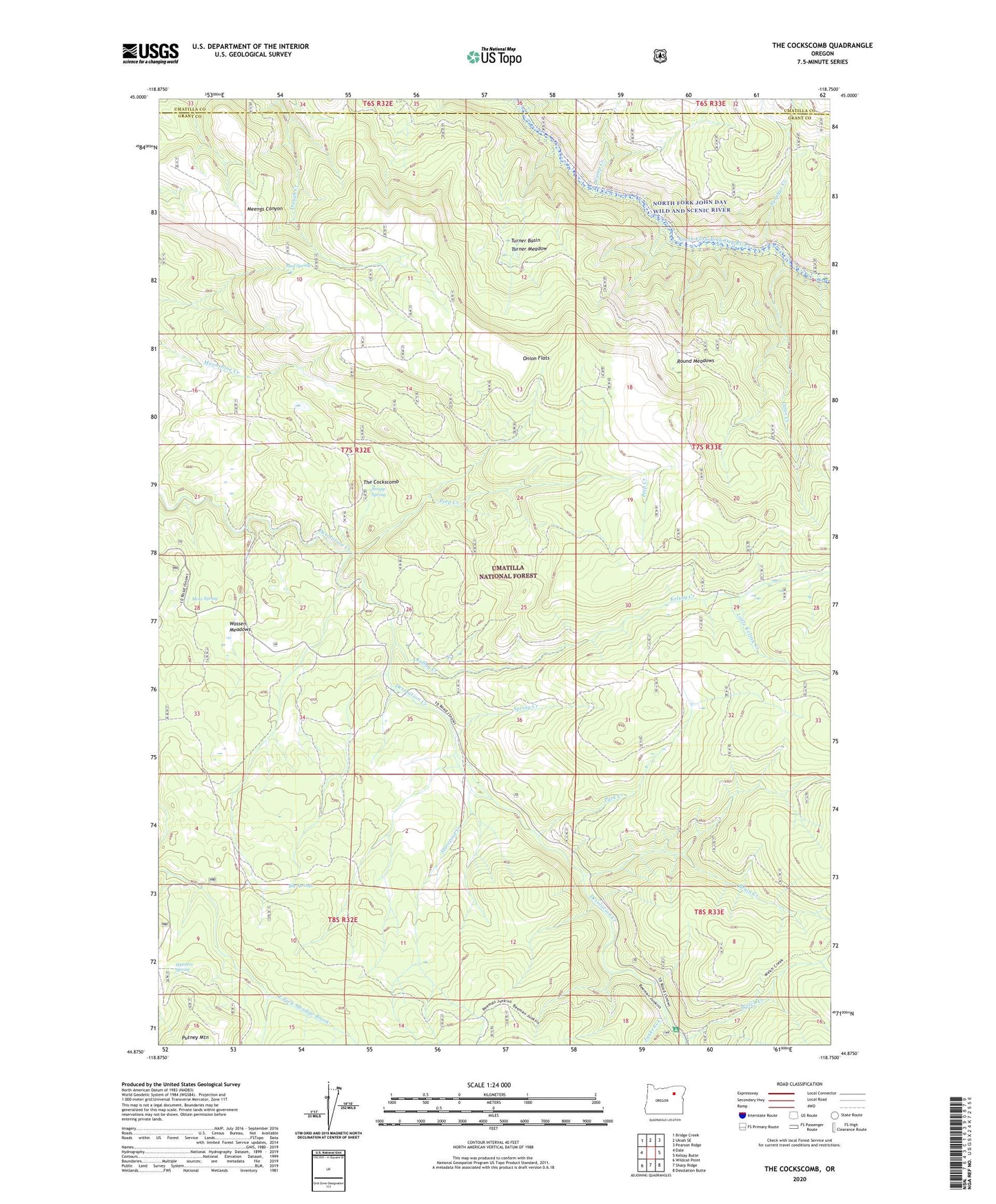
The Cockscomb Oregon US Topo Map
Couldn't load pickup availability
Also explore the The Cockscomb Forest Service Topo of this same quad for updated USFS data
2023 topographic map quadrangle The Cockscomb in the state of Oregon. Scale: 1:24000. Based on the newly updated USGS 7.5' US Topo map series, this map is in the following counties: Grant, Umatilla. The map contains contour data, water features, and other items you are used to seeing on USGS maps, but also has updated roads and other features. This is the next generation of topographic maps. Printed on high-quality waterproof paper with UV fade-resistant inks.
Quads adjacent to this one:
West: Dale
Northwest: Bridge Creek
North: Ukiah SE
Northeast: Pearson Ridge
East: Kelsay Butte
Southeast: Desolation Butte
South: Sharp Ridge
Southwest: Wildcat Point
This map covers the same area as the classic USGS quad with code o44118h7.
Contains the following named places: Big Springs, Blue Bucket Mine, Bruin Creek, Camp Creek, Hunters Spring, Junkens Creek, Kelsay Creek, Little Kelsay Creek, Lower End Camp, Mote Spring, Mud Spring, Onion Flats, Otter Creek, Park Creek, Peep Creek, Peep Creek Camp, Peep Creek Trail, Round Meadows, Snapp Spring, Spring Creek, Starveout Creek, Sulphur Creek, The Cockscomb, Trough Creek Trail, Turner Basin, Turner Meadow, Wassen Meadows, Welch Creek, Welch Creek Recreation Site