MyTopo
Kelsay Butte Oregon US Topo Map
Couldn't load pickup availability
Also explore the Kelsay Butte Forest Service Topo of this same quad for updated USFS data
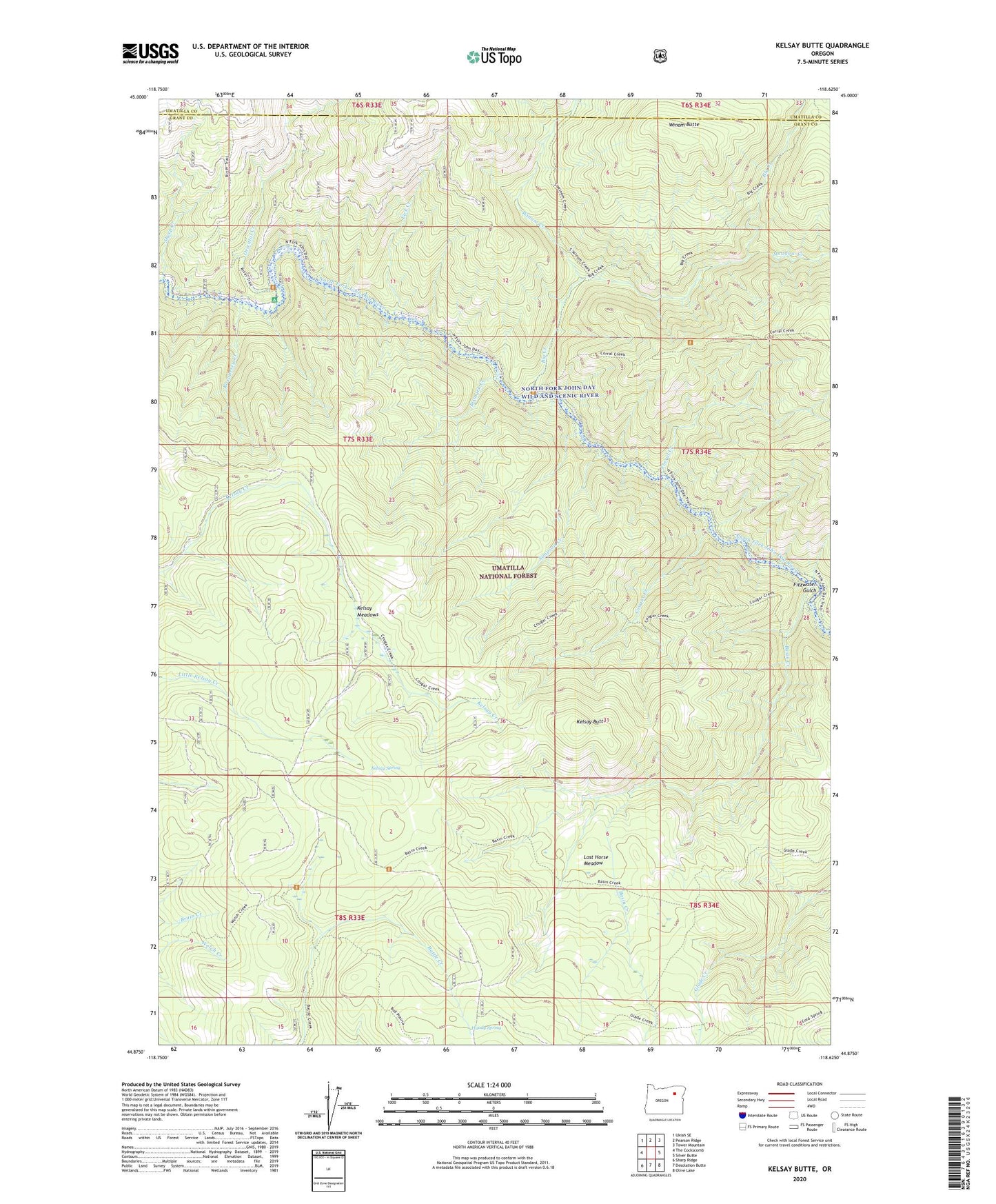
2023 topographic map quadrangle Kelsay Butte in the state of Oregon. Scale: 1:24000. Based on the newly updated USGS 7.5' US Topo map series, this map is in the following counties: Grant, Umatilla. The map contains contour data, water features, and other items you are used to seeing on USGS maps, but also has updated roads and other features. This is the next generation of topographic maps. Printed on high-quality waterproof paper with UV fade-resistant inks.
Quads adjacent to this one:
West: The Cockscomb
Northwest: Ukiah SE
North: Pearson Ridge
Northeast: Tower Mountain
East: Silver Butte
Southeast: Olive Lake
South: Desolation Butte
Southwest: Sharp Ridge
This map covers the same area as the classic USGS quad with code o44118h6.
Contains the following named places: Basin Camp, Basin Creek, Basin Creek Trail, Battle Creek Camp, Battle Creek Guard Station, Big Creek, Bismark Creek, Bull Prairie Trail, Cold Spring Camp, Corral Creek, Corral Creek Trail, Cougar Creek, Cougar Creek Trail, Fitzwater Gulch, Glade Creek Trail, Handy Spring, Kelsay Butte, Kelsay Butte Trail, Kelsay Meadows, Kelsay Spring, Lick Creek, Lost Horse Meadow, Lower Cougar Camp, Meadow Creek, Mutton Camp, Old Desolation Driveway Trail, Oriental Creek, Oriental Creek Recreation Site, Raspberry Creek, Sheep Creek, Simpson Creek, Upper Cougar Camp, Welch Creek Mine, Welch Creek Trail, Winom Butte, Winom Creek