MyTopo
Poison Creek Oregon US Topo Map
Couldn't load pickup availability
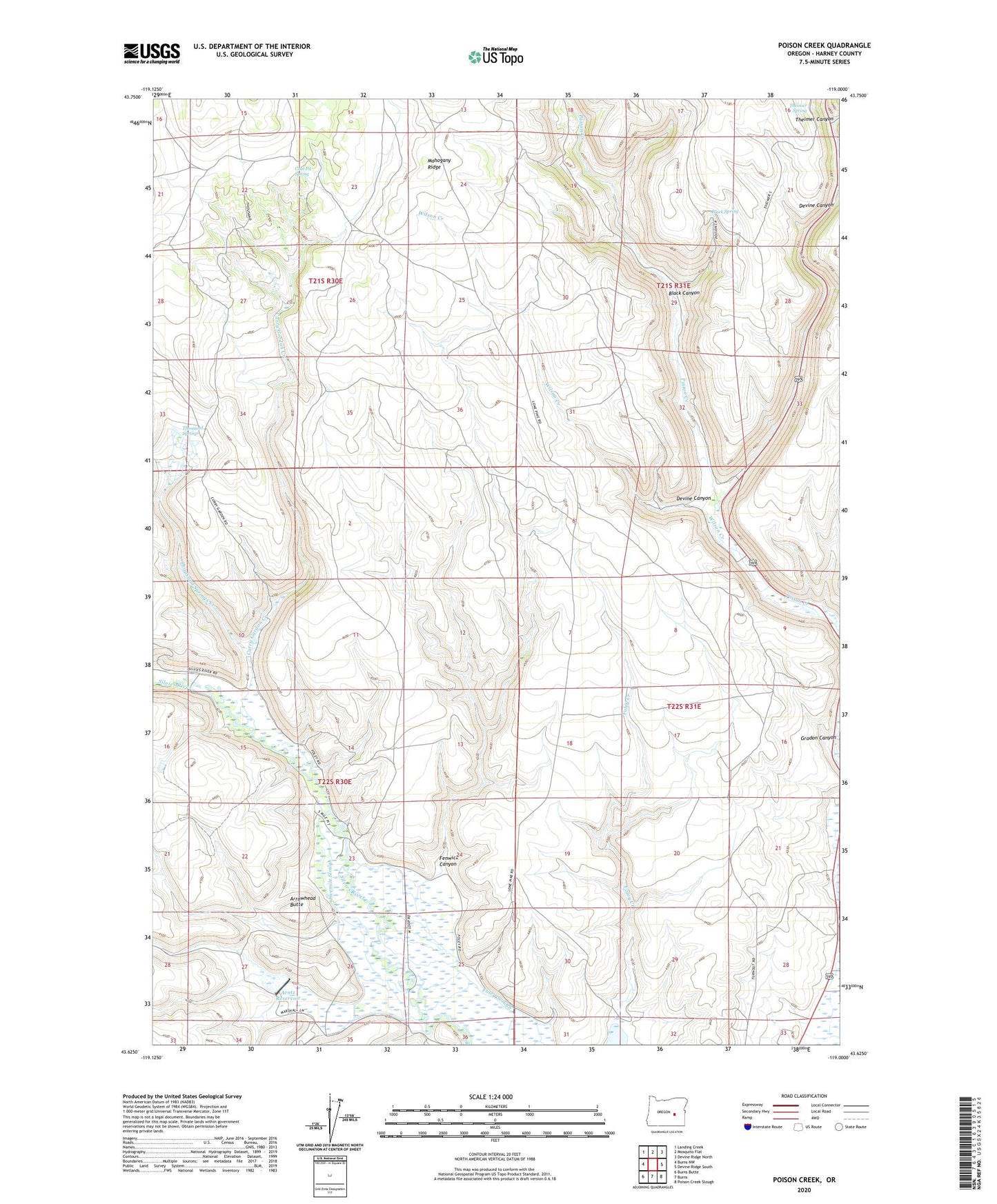
2023 topographic map quadrangle Poison Creek in the state of Oregon. Scale: 1:24000. Based on the newly updated USGS 7.5' US Topo map series, this map is in the following counties: Harney. The map contains contour data, water features, and other items you are used to seeing on USGS maps, but also has updated roads and other features. This is the next generation of topographic maps. Printed on high-quality waterproof paper with UV fade-resistant inks.
Quads adjacent to this one:
West: Burns NW
Northwest: Landing Creek
North: Mosquito Flat
Northeast: Devine Ridge North
East: Devine Ridge South
Southeast: Poison Creek Slough
South: Burns
Southwest: Burns Butte
This map covers the same area as the classic USGS quad with code o43119f1.
Contains the following named places: Arntz Dam, Arntz Reservoir, Arrowhead Butte, Baker Ranch, Black Canyon, Black Ranch, Black Spring, Coal Pit Spring, Curry Gordon Creek, Devils Garden, Devine Canyon, Fenwick Canyon, Fivemile Dam, Fivemile Slough, Foley Creek, Gradon Canyon, Hart Ranch, Hayes Ranch, Peterson Ranch, Poison Creek, Savage Slough, Sylvester Place, Theimer Canyon, Theimer Spring, Thousand Springs, Thousand Springs Creek, Thousand Springs Ranch, Wilson Creek