MyTopo
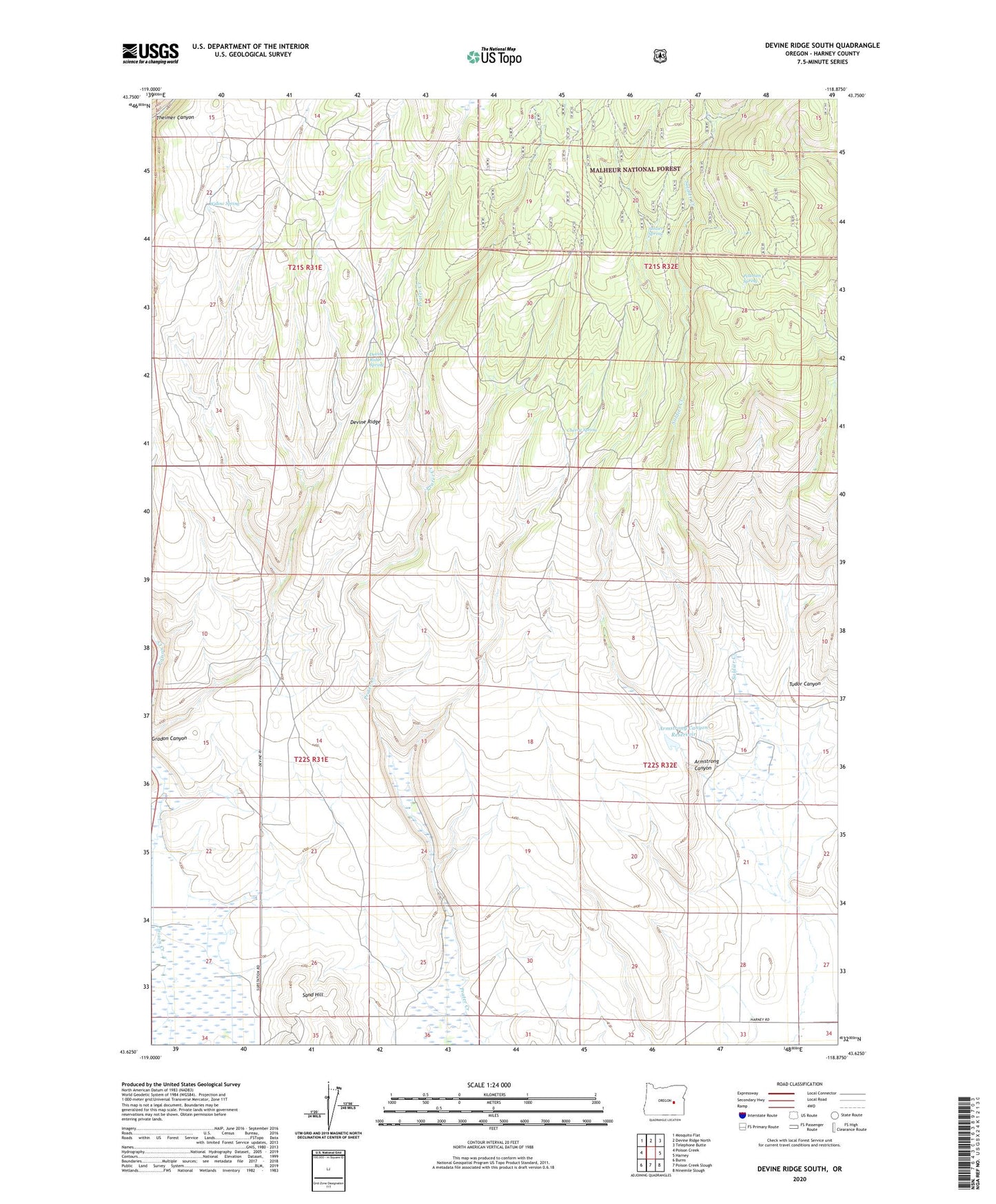
Devine Ridge South Oregon US Topo Map
Couldn't load pickup availability
Also explore the Devine Ridge South Forest Service Topo of this same quad for updated USFS data
2023 topographic map quadrangle Devine Ridge South in the state of Oregon. Scale: 1:24000. Based on the newly updated USGS 7.5' US Topo map series, this map is in the following counties: Harney. The map contains contour data, water features, and other items you are used to seeing on USGS maps, but also has updated roads and other features. This is the next generation of topographic maps. Printed on high-quality waterproof paper with UV fade-resistant inks.
Quads adjacent to this one:
West: Poison Creek
Northwest: Mosquito Flat
North: Devine Ridge North
Northeast: Telephone Butte
East: Harney
Southeast: Ninemile Slough
South: Poison Creek Slough
Southwest: Burns
This map covers the same area as the classic USGS quad with code o43118f8.
Contains the following named places: Armstrong Canyon, Armstrong Canyon Reservoir, Byrd Canyon, Cherry Spring, Danforth Ditch, Devine Ridge Spring, Jameson Ranch, Old Graham Homestead, Petersen Spring, Pon Well, Sand Hill, Soldier Creek, Soldier Spring, Tudor Canyon, Uncle Tom Well, Widow Spring, Williams Ranch