MyTopo
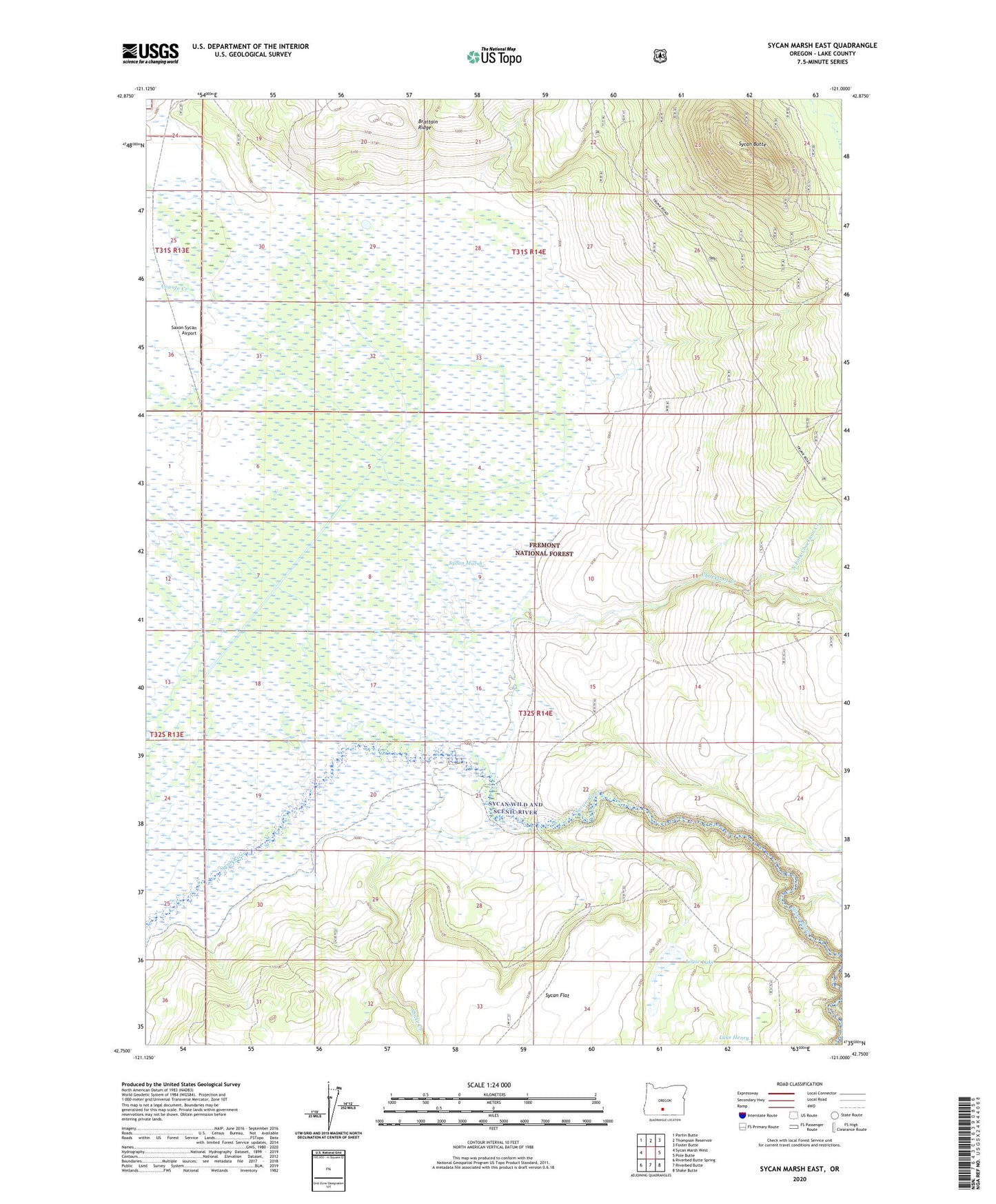
Sycan Marsh East Oregon US Topo Map
Couldn't load pickup availability
Also explore the Sycan Marsh East Forest Service Topo of this same quad for updated USFS data
2024 topographic map quadrangle Sycan Marsh East in the state of Oregon. Scale: 1:24000. Based on the newly updated USGS 7.5' US Topo map series, this map is in the following counties: Lake. The map contains contour data, water features, and other items you are used to seeing on USGS maps, but also has updated roads and other features. This is the next generation of topographic maps. Printed on high-quality waterproof paper with UV fade-resistant inks.
Quads adjacent to this one:
West: Sycan Marsh West
Northwest: Partin Butte
North: Thompson Reservoir
Northeast: Foster Butte
East: Pole Butte
Southeast: Shake Butte
South: Riverbed Butte
Southwest: Riverbed Butte Spring
This map covers the same area as the classic USGS quad with code o42121g1.
Contains the following named places: Brattain Ranch, Chocktoot Creek, Coyote Creek, Lake Henry, Long Creek, Louse Lake, North Fork Chocktoot Creek, Saxon Sycan Airport, Shake Creek, Sycan Butte, Sycan Butte Lookout, Sycan Marsh, Sycan Wild and Scenic River, ZX Ranch