MyTopo
Post Oregon US Topo Map
Couldn't load pickup availability
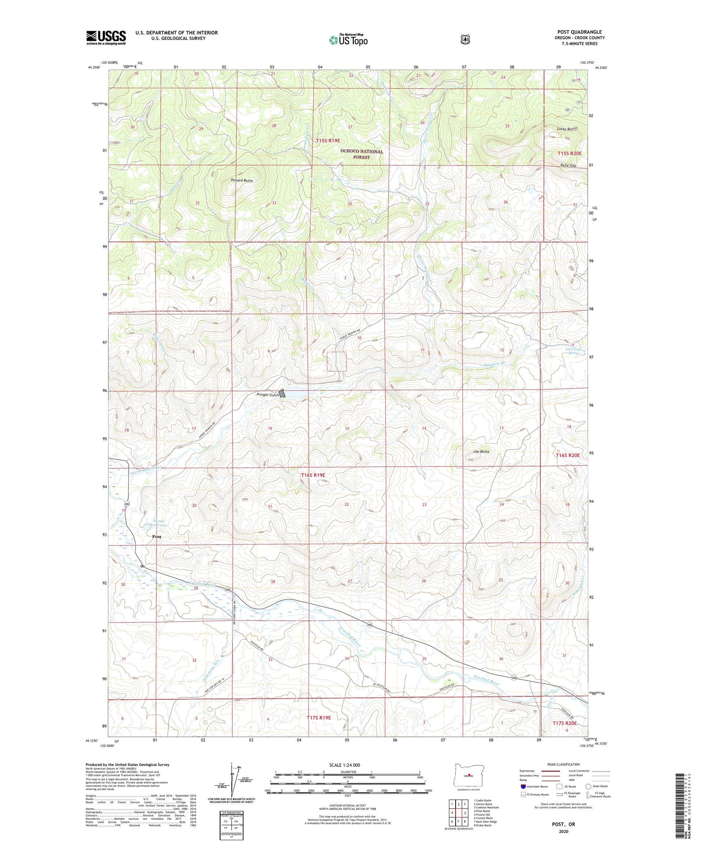
2020 topographic map quadrangle Post in the state of Oregon. Scale: 1:24000. Based on the newly updated USGS 7.5' US Topo map series, this map is in the following counties: Crook. The map contains contour data, water features, and other items you are used to seeing on USGS maps, but also has updated roads and other features. This is the next generation of topographic maps. Printed on high-quality waterproof paper with UV fade-resistant inks.
Quads adjacent to this one:
West: Pilot Butte
Northwest: Cadle Butte
North: Gerow Butte
Northeast: Lookout Mountain
East: Prairie Hill
Southeast: Drake Butte
South: Mule Deer Ridge
Southwest: Conant Basin
Contains the following named places: Bonnieview Dam, Bonnieview Ranch, Bootan Ranch, Brown Creek, Hide Canyon, Horse Heaven Creek, Horse Heaven Reservoir, Joe Butte, Kelly Gap, Lava Point Spring, Lucky Butte, Meadow Branch, Newsome Creek, Pine Creek, Pine Stub Creek, Pollard Butte, Post, Post Post Office, Post School, Pringle Creek, Pringle Gulch, R Knox Ranch, Shoun Reservoir, Tamarack Creek