MyTopo
Powell Buttes Oregon US Topo Map
Couldn't load pickup availability
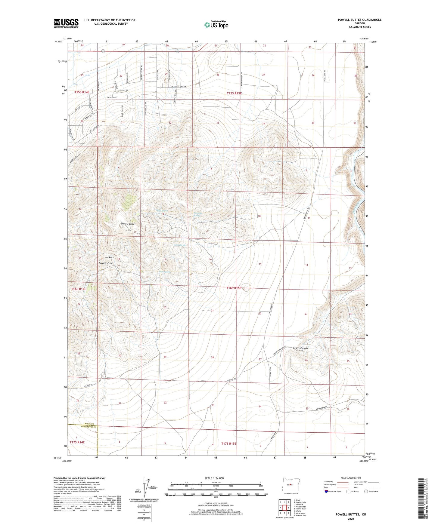
2020 topographic map quadrangle Powell Buttes in the state of Oregon. Scale: 1:24000. Based on the newly updated USGS 7.5' US Topo map series, this map is in the following counties: Crook, Deschutes. The map contains contour data, water features, and other items you are used to seeing on USGS maps, but also has updated roads and other features. This is the next generation of topographic maps. Printed on high-quality waterproof paper with UV fade-resistant inks.
Quads adjacent to this one:
West: Powell Butte
North: Houston Lake
Northeast: Prineville
East: Stearns Butte
Southeast: Bowman Dam
South: Horse Butte
Southwest: Alfalfa
Contains the following named places: Baldwin Dam, Casey Spring, Dempsey Spring, Hat Rock, Hat Rock Post Office, Ponderosa Substation, Powell Buttes, Red Cloud Ranch, Rooster Comb, Statz Spring, Three Spring Ranch, Wells Spring