MyTopo
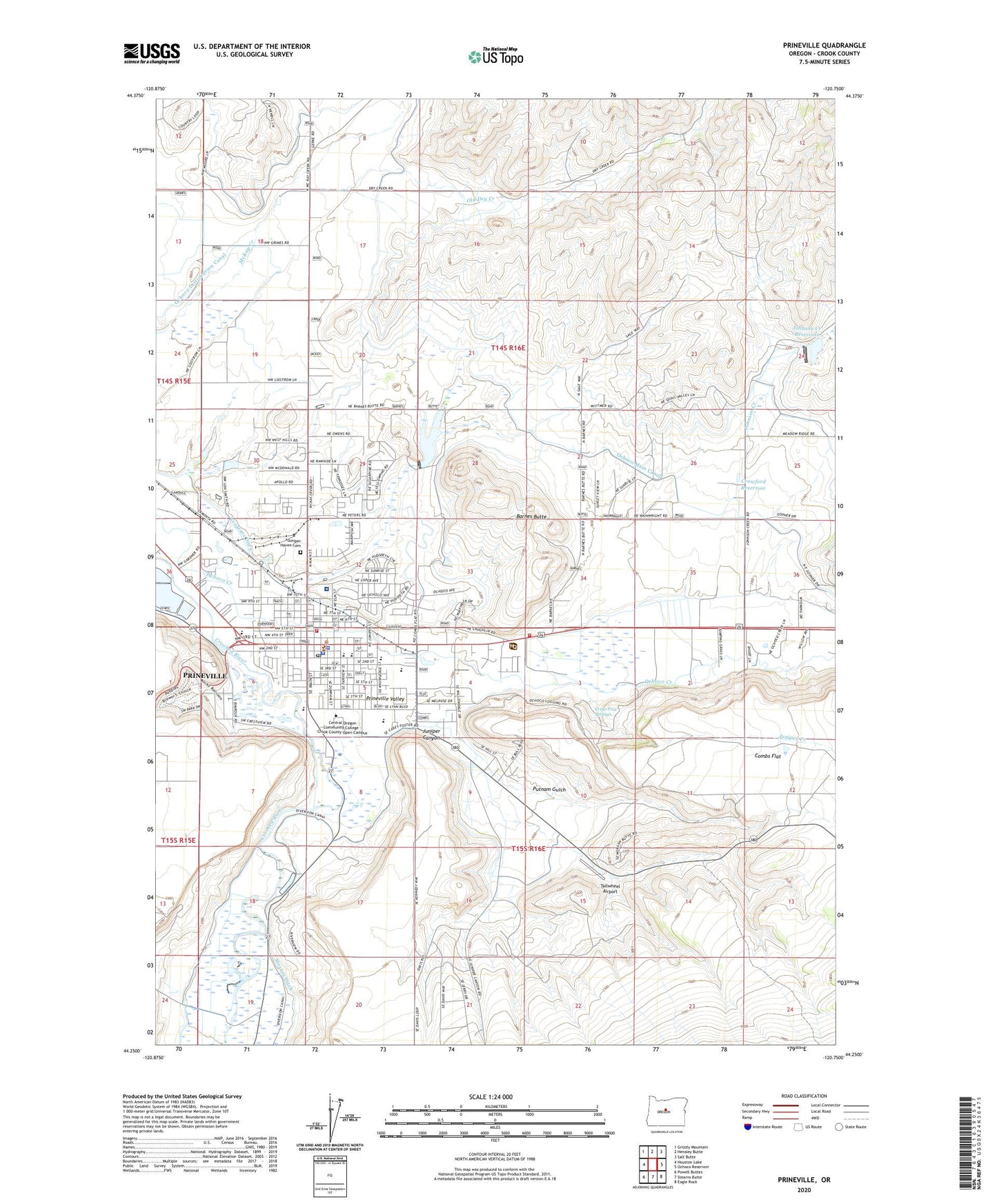
Prineville Oregon US Topo Map
Couldn't load pickup availability
Also explore the Prineville Forest Service Topo of this same quad for updated USFS data
2023 topographic map quadrangle Prineville in the state of Oregon. Scale: 1:24000. Based on the newly updated USGS 7.5' US Topo map series, this map is in the following counties: Crook. The map contains contour data, water features, and other items you are used to seeing on USGS maps, but also has updated roads and other features. This is the next generation of topographic maps. Printed on high-quality waterproof paper with UV fade-resistant inks.
Quads adjacent to this one:
West: Houston Lake
Northwest: Grizzly Mountain
North: Hensley Butte
Northeast: Salt Butte
East: Ochoco Reservoir
Southeast: Eagle Rock
South: Stearns Butte
Southwest: Powell Buttes
This map covers the same area as the classic USGS quad with code o44120c7.
Contains the following named places: A R Bowman Memorial Museum, Barnes Butte, Barnes Butte Dam, Barnes Butte Reservoir, Breese Ranch, Bureau of Land Management Prineville District Office, Cascades East Transit Prineville Park and Ride, Cecil Sly Elementary School, City of Prineville, Crawford Reservoir, Crook County Courthouse and Circuit Court, Crook County Fairgrounds, Crook County Fairgrounds Carey Foster Hall, Crook County Fairgrounds Indoor Arena, Crook County Fairgrounds Outdoor Arena, Crook County Fire and Rescue Main Station, Crook County Health Department, Crook County High School, Crook County Jail, Crook County Library, Crook County Middle School, Crook County Sheriff's Office, Crooked River Elementary School, Crooked River Park, Crow Foot Springs, Davidson Park, Department of Motor Vehicles Prineville, Gary A Ward Park, Harwood Park, Johnson Creek, Johnson Creek Dam, Johnson Creek Reservoir, Juniper Canyon, Juniper Creek, Juniper Haven Cemetery, Kilowatt Park, Library Park, Lookout Mountain Ranger Station, Mini Park, Mountain View Park, Ochoco Creek Park, Ochoco Distribution Canal, Ochoco Elementary School, Ochoco Main Canal, Ochoco National Forest Headquarters, Ochoco Relift Pumping Plant, Ochoco State Park, Old Dry Creek, Oregon State Forestry District Headquarters, Paulina Ranger District, Pioneer Memorial Hospital Heliport, Pioneer Memorial Hospital Prineville, Pioneer Park, Pioneer Secondary Alternative High School, Prineville, Prineville and Crooked River National Grassland Headquarters, Prineville City Hall, Prineville Golf and Country Club, Prineville Police Department, Prineville Post Office, Prineville Public Works Department Office, Prineville Ranger Station, Prineville Sewage Treatment Facility, Putnam Gulch, Rimrock Park, Rimrock Trails Adolescent Treatment Services Treatment Center, Ryegrass Ditch, Stryker Park, Tailwheel Airport, Ward Rhoden Stadium