MyTopo
Prairie Hill Oregon US Topo Map
Couldn't load pickup availability
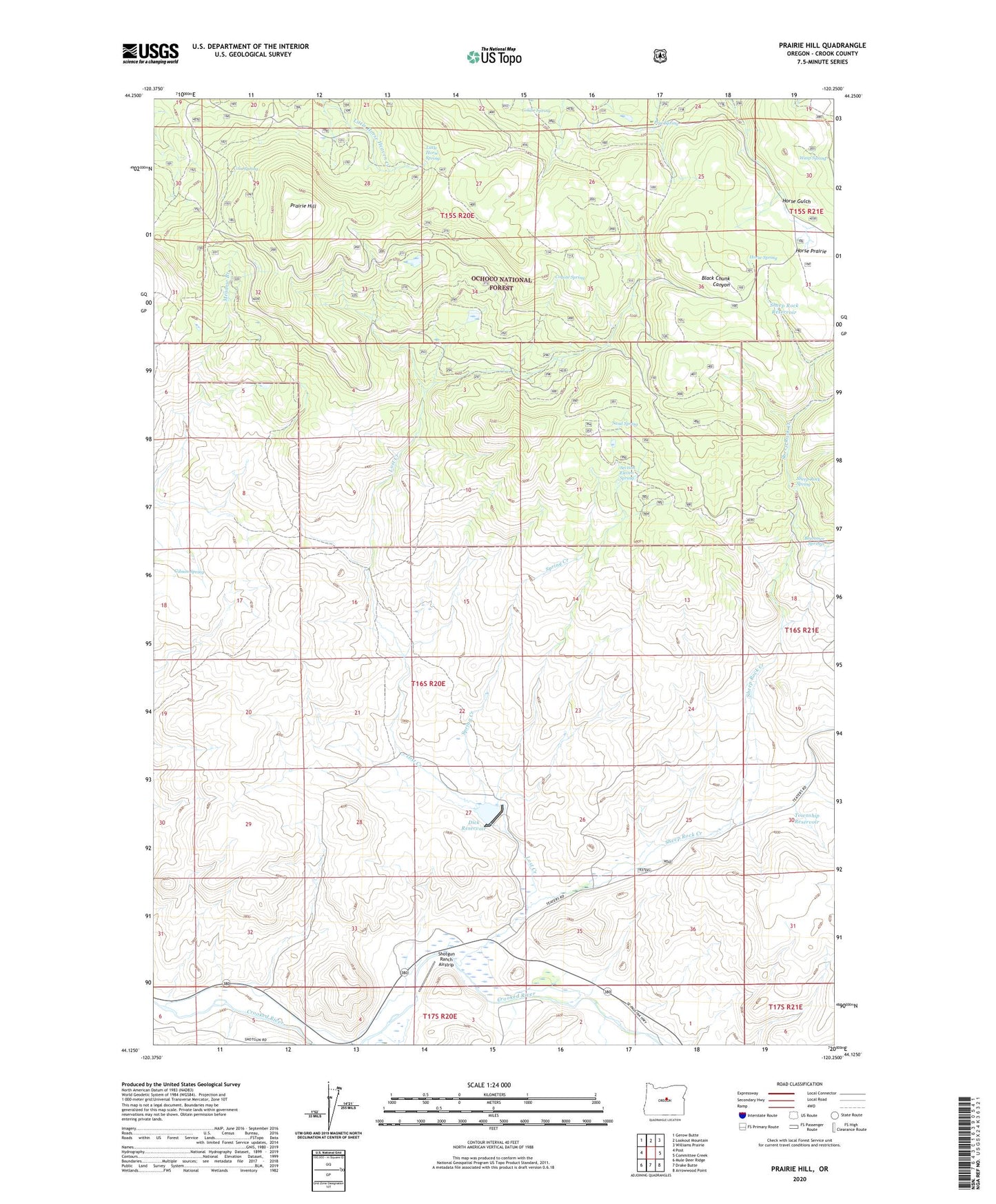
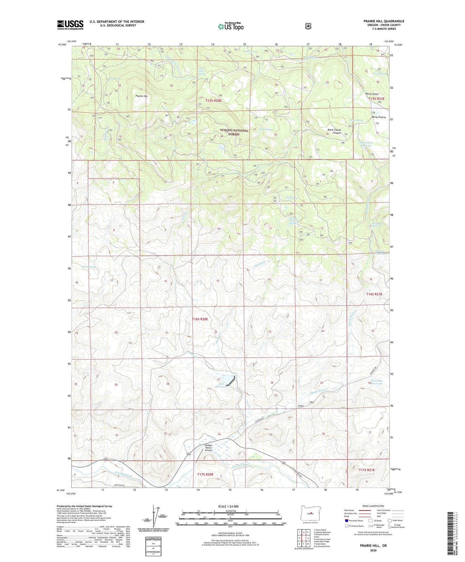
2020 topographic map quadrangle Prairie Hill in the state of Oregon. Scale: 1:24000. Based on the newly updated USGS 7.5' US Topo map series, this map is in the following counties: Crook. The map contains contour data, water features, and other items you are used to seeing on USGS maps, but also has updated roads and other features. This is the next generation of topographic maps. Printed on high-quality waterproof paper with UV fade-resistant inks.
Quads adjacent to this one:
West: Post
Northwest: Gerow Butte
North: Lookout Mountain
Northeast: Williams Prairie
East: Committee Creek
Southeast: Arrowwood Point
South: Drake Butte
Southwest: Mule Deer Ridge
Contains the following named places: Brummer Springs, Coin Spring, Coyote Spring, Crook County, Dick Dam, Dick Ranch, Dick Reservoir, Gibson Spring, Goldie Spring, Horse Prairie, Horse Spring, Keeney Creek, Little Horse Spring, Lost Creek, Pipe Spring, Prairie Hill, Sand Spring, Section Eleven Spring, Sheep Rock Creek, Sheep Rock Reservoir, Sheep Rock Spring, Shotgun Ranch Airstrip, Spring Creek, Township Reservoir, Wasp Spring, ZIP Code: 97752