MyTopo
Quartz Valley Oregon US Topo Map
Couldn't load pickup availability
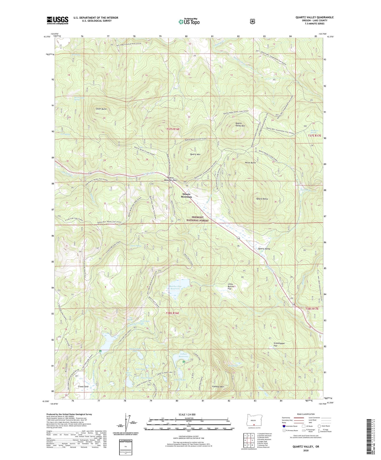
2020 topographic map quadrangle Quartz Valley in the state of Oregon. Scale: 1:24000. Based on the newly updated USGS 7.5' US Topo map series, this map is in the following counties: Lake. The map contains contour data, water features, and other items you are used to seeing on USGS maps, but also has updated roads and other features. This is the next generation of topographic maps. Printed on high-quality waterproof paper with UV fade-resistant inks.
Quads adjacent to this one:
West: Paradise Mountain
Northwest: Campbell Reservoir
North: Gearhart Mountain
Northeast: Coleman Point
East: Cougar Peak
Southeast: Drews Reservoir
South: Arkansas Flat
Southwest: Barnes Valley
Contains the following named places: Angel Camp, Angel Spring, Beaverdam Lake, Beer Garden Spring, Bill Spring, Buckhorn Spring, Butcher Flat, Butcher Flat Reservoir, Dallas Lake Dam, Doe Spring, Ewauna Camp, Fern Spring, Fishhole Guard Station, Fishhole Mountain, Fishhole Recreation Site, Grasshopper Flat, Heart Lake, Heart Lake Landing Boat Launch, Heart Lake Recreation Site, Holbrook Dam, Holbrook Reservoir, Holbrook Reservoir Boat Launch, Holbrook Reservoir Recreation Site, Indigo Creek, Little Butcher Flat, Lofton Campground Boat Ramp, Lofton Dam, Lofton Lake, Lofton Reservoir, Lofton Reservoir Recreation Site, Mud Lake, North Butte, Ornoname 2 Dam, Owen Butte, Petes Puddle, Quartz Butte, Quartz Creek, Quartz Mountain, Quartz Mountain Pass, Quartz Mountain Post Office, Quartz Mountain Sno-Park, Quartz Valley, Quartz Valley Mountain, Spatterdock Lake, Tower Spring, Tule Pond, Whitworth Creek