MyTopo
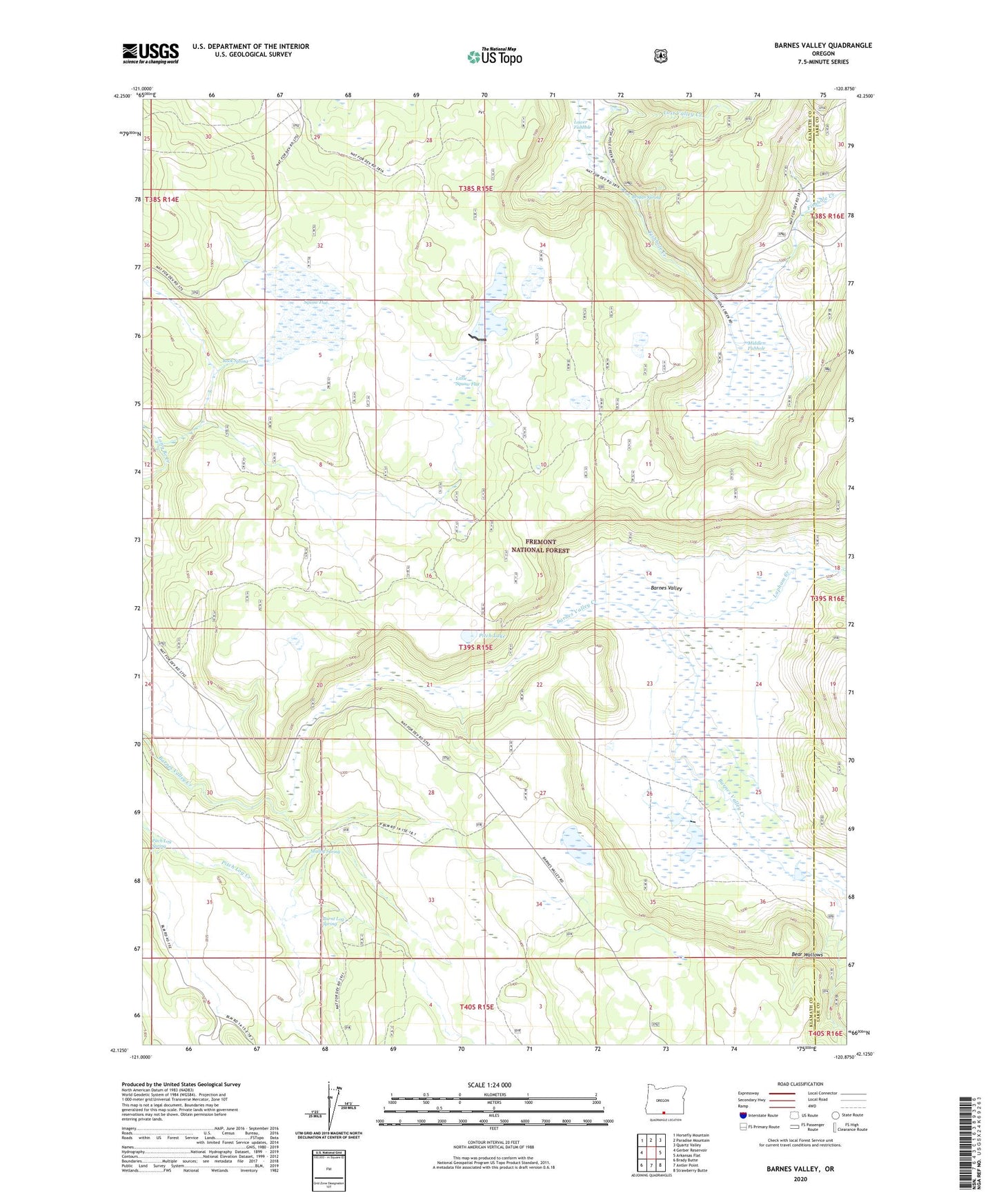
Barnes Valley Oregon US Topo Map
Couldn't load pickup availability
Also explore the Barnes Valley Forest Service Topo of this same quad for updated USFS data
2023 topographic map quadrangle Barnes Valley in the state of Oregon. Scale: 1:24000. Based on the newly updated USGS 7.5' US Topo map series, this map is in the following counties: Klamath, Lake. The map contains contour data, water features, and other items you are used to seeing on USGS maps, but also has updated roads and other features. This is the next generation of topographic maps. Printed on high-quality waterproof paper with UV fade-resistant inks.
Quads adjacent to this one:
West: Gerber Reservoir
Northwest: Horsefly Mountain
North: Paradise Mountain
Northeast: Quartz Valley
East: Arkansas Flat
Southeast: Strawberry Butte
South: Antler Point
Southwest: Brady Butte
This map covers the same area as the classic USGS quad with code o42120b8.
Contains the following named places: Barnes Valley, Barnes Valley Guard Station, Briggs Spring, Burnt Log Spring, DeVaul Ranch, Hunt Ranch, Lapham Creek, Little Squaw Flat, Little Squaw Flat Reservoir, Lloyd Gift Dam, Loraton Post Office, Lost Valley Creek, Lower Fishhole, Malloy Spring, Middle Fishhole, Oriana Corrals, Oxbow Dam, Pitch Lake, Pitch Log Spring, Rock Spring, Simmons Ranch, Squaw Flat, Tull Reservoir