MyTopo
Rabbit Valley Oregon US Topo Map
Couldn't load pickup availability
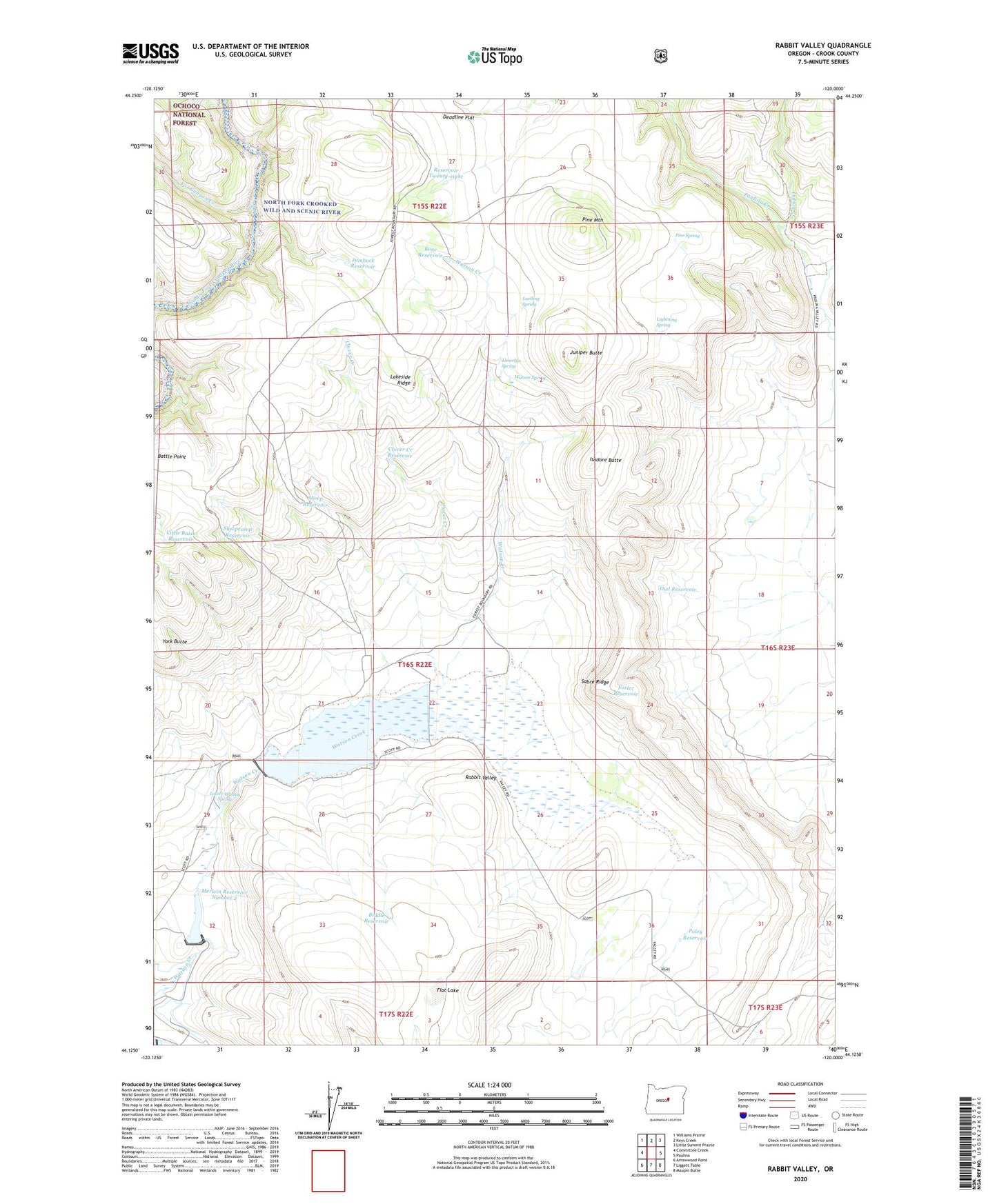
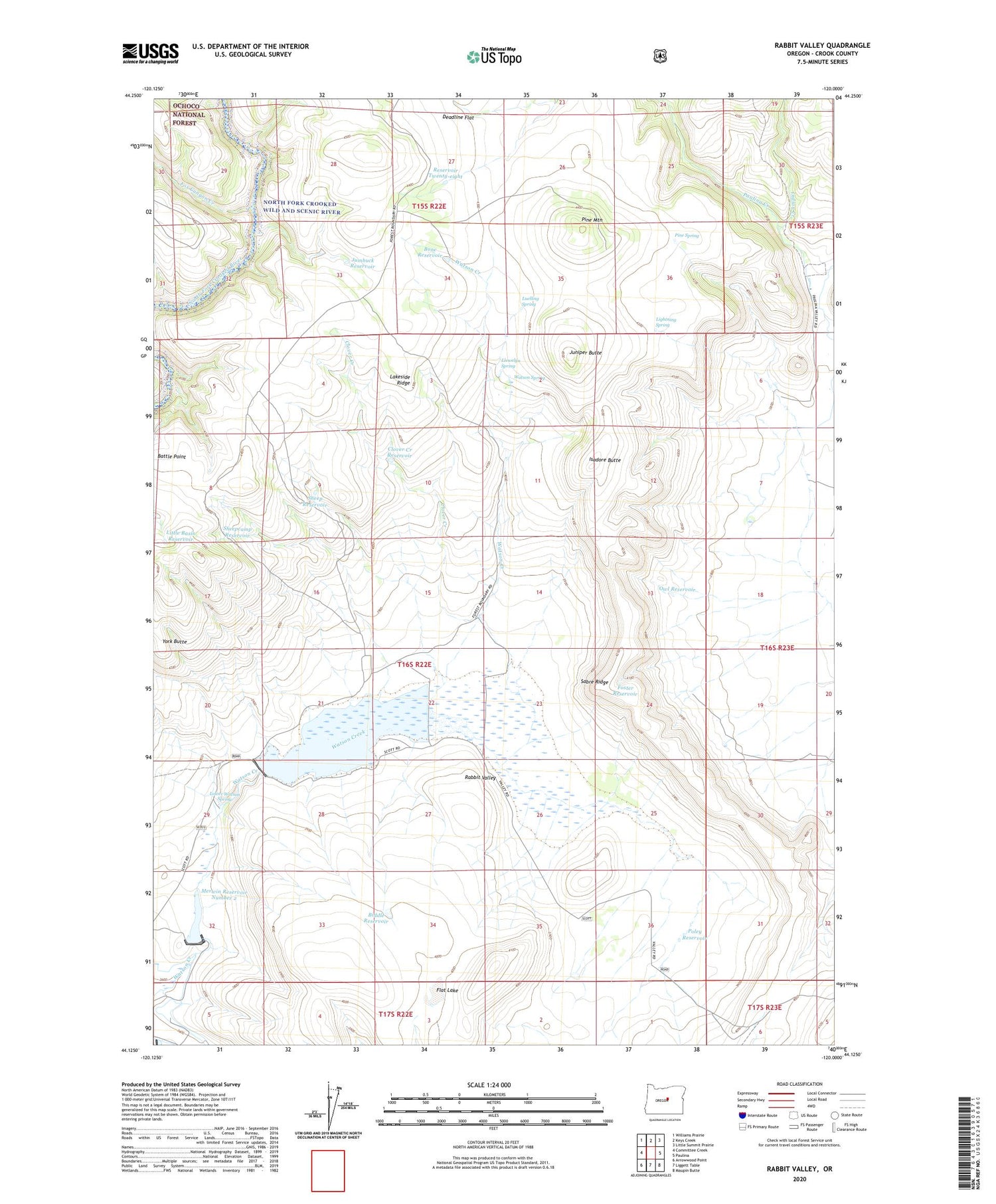
2020 topographic map quadrangle Rabbit Valley in the state of Oregon. Scale: 1:24000. Based on the newly updated USGS 7.5' US Topo map series, this map is in the following counties: Crook. The map contains contour data, water features, and other items you are used to seeing on USGS maps, but also has updated roads and other features. This is the next generation of topographic maps. Printed on high-quality waterproof paper with UV fade-resistant inks.
Quads adjacent to this one:
West: Committee Creek
Northwest: Williams Prairie
North: Keys Creek
Northeast: Little Summit Prairie
East: Paulina
Southeast: Maupin Butte
South: Liggett Table
Southwest: Arrowwood Point
Contains the following named places: Biddle Reservoir, Bone Reservoir, Clover Creek, Clover Creek Reservoir, Deadline Flat, Flat Lake, Foster Reservoir, Fox Canyon Creek, Gale-Merwin Dam, Indian Creek, Isadore Butte, Isadore Ranch, Jumbuck Reservoir, Juniper Butte, Lakeside Ridge, Lightning Spring, Little Basin Reservoir, Llewelyn Spring, Lower Watson Spring, Luelling Spring, Merwin Dam Number 2, Merwin Dam Number 3, Merwin Reservoir Number 2, Merwin Reservoir Number Three, Owl Reservoir, Pine Mountain, Pine Spring, Poley Reservoir, Rabbit Valley, Reservoir Twenty-eight, Roba Creek, Sabre Ridge, Sheep Reservoir, Sheepcamp Reservoir, Watson Butte, Watson Dam, Watson Reservoir, Watson Spring, York Butte