MyTopo
Tiller Oregon US Topo Map
Couldn't load pickup availability
Also explore the Tiller Forest Service Topo of this same quad for updated USFS data
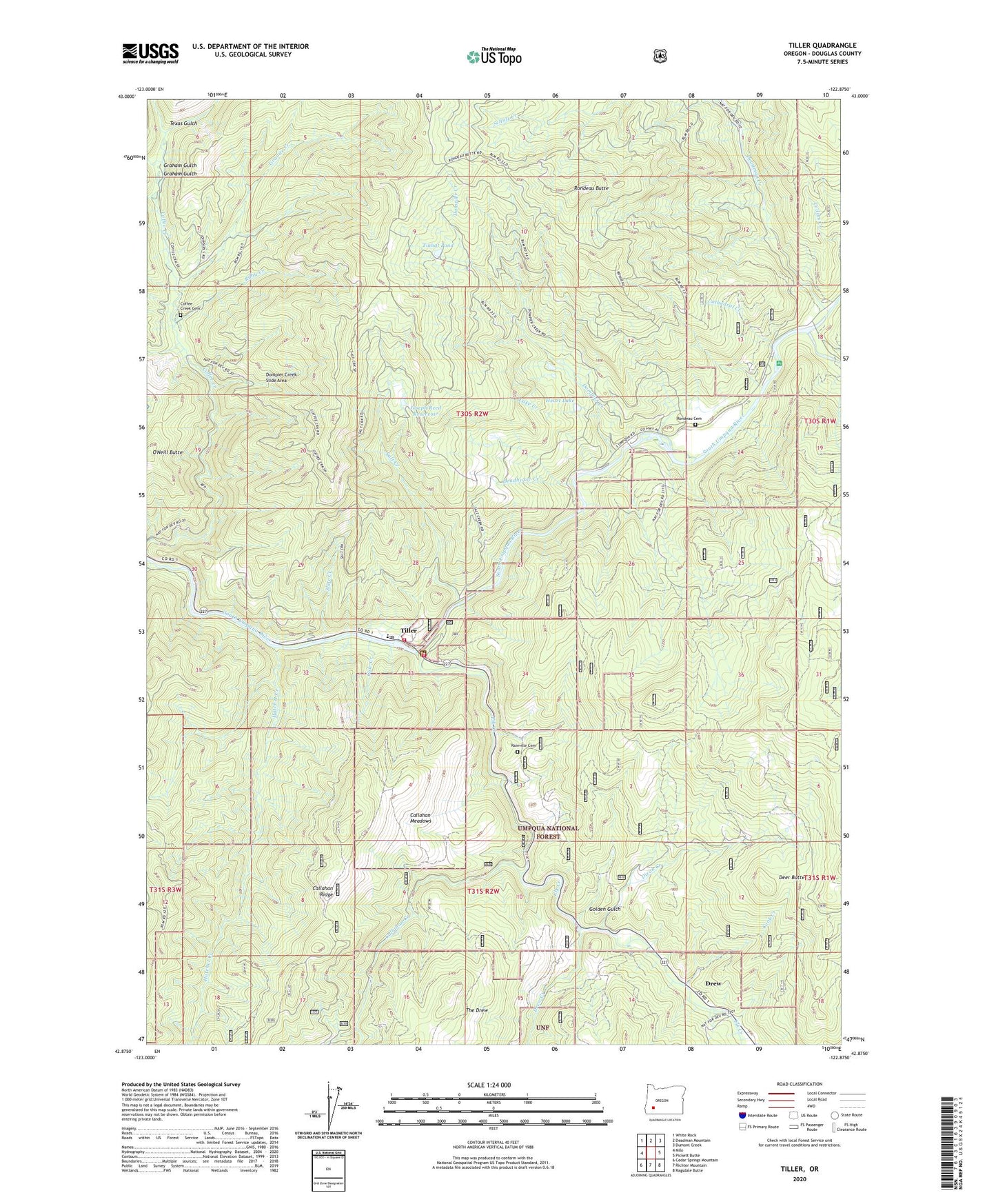
2023 topographic map quadrangle Tiller in the state of Oregon. Scale: 1:24000. Based on the newly updated USGS 7.5' US Topo map series, this map is in the following counties: Douglas. The map contains contour data, water features, and other items you are used to seeing on USGS maps, but also has updated roads and other features. This is the next generation of topographic maps. Printed on high-quality waterproof paper with UV fade-resistant inks.
Quads adjacent to this one:
West: Milo
Northwest: White Rock
North: Deadman Mountain
Northeast: Dumont Creek
East: Pickett Butte
Southeast: Ragsdale Butte
South: Richter Mountain
Southwest: Cedar Springs Mountain
This map covers the same area as the classic USGS quad with code o42122h8.
Contains the following named places: Brown Ranch, Callahan Creek, Callahan Lookout, Callahan Meadows, Callahan Ridge, Camp Creek, Cathedral Creek, Coffee Creek Cemetery, Cole Creek, Cook Creek, Cow Creek, Deadhorse Creek, Deadman Creek, Deer Butte, Dixon Creek, Dompier Creek, Dompier Creek Slide Area, Drew, Drew Creek, Drew Post Office, Drew School, Elk Creek, Golden Gulch, Graham Gulch, Granite Creek, Hatchet Creek, Heart Lake, Jackson Creek, Joseph Reed Dam, Joseph Reed Reservoir, Lake Creek, Lucas Ranch, Marshall Place, Neet Post Office, O'Neill Butte, Rainville Cemetery, Rondeau Butte, Rondeau Cemetery, Ruby Creek, Salt Creek, Slate Creek, South Umpqua Division, Texas Gulch, Three C Rock Campground Boat Launch, Three C Rock Recreation Site, Tiller, Tiller Elementary School, Tiller Post Office, Tiller Ranger Station, Tiller Rural Fire Protection District Headquarters, Tinhat Pond, United States Forest Service Tiller Ranger District