MyTopo
Rigdon Point Oregon US Topo Map
Couldn't load pickup availability
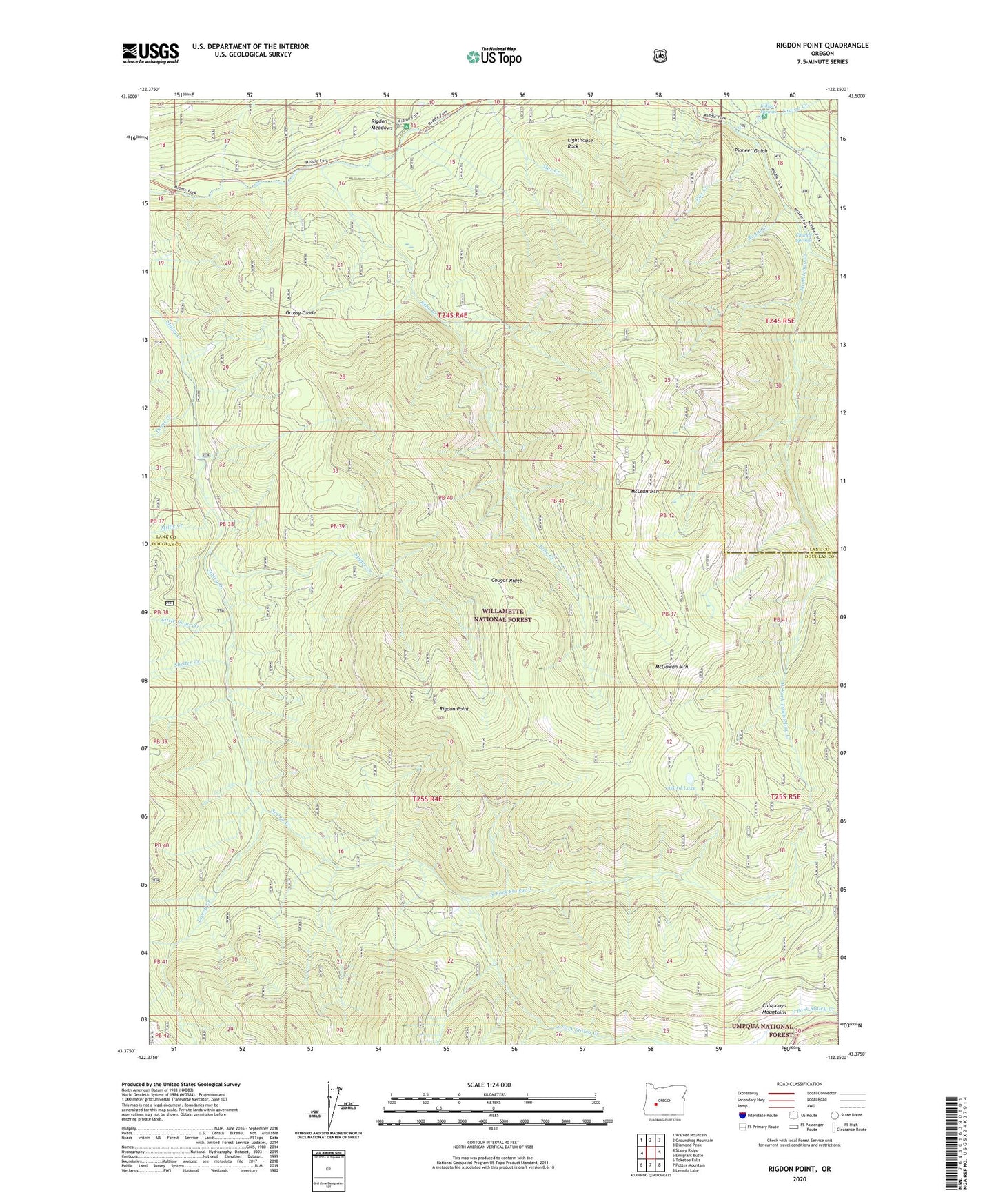
2020 topographic map quadrangle Rigdon Point in the state of Oregon. Scale: 1:24000. Based on the newly updated USGS 7.5' US Topo map series, this map is in the following counties: Lane, Douglas. The map contains contour data, water features, and other items you are used to seeing on USGS maps, but also has updated roads and other features. This is the next generation of topographic maps. Printed on high-quality waterproof paper with UV fade-resistant inks.
Quads adjacent to this one:
West: Staley Ridge
Northwest: Warner Mountain
North: Groundhog Mountain
Northeast: Diamond Peak
East: Emigrant Butte
Southeast: Lemolo Lake
South: Potter Mountain
Southwest: Toketee Falls
Contains the following named places: Chuckle Springs, Cougar Ridge, Davey Creek, Dome Creek, Echo Creek, Echo Creek Trail, Fizz Creek, Grassy Glade, Indigo Creek, Indigo Springs, Indigo Springs Recreation Site, Lighthouse Rock, Little Dome Creek, Lizard Lake, McGowan Mountain, McLean Mountain, Millie Creek, North Fork Staley Creek, Old Burn Way, Pioneer Gulch, Rigdon Guard Station, Rigdon Meadows, Rigdon Point, Royal Creek, Sacandaga Recreation Site, Shelter Creek, South Fork Staley Creek, Spider Creek, Tumblebug Creek, Tumblebug Way, West Fork Tumblebug Creek