MyTopo
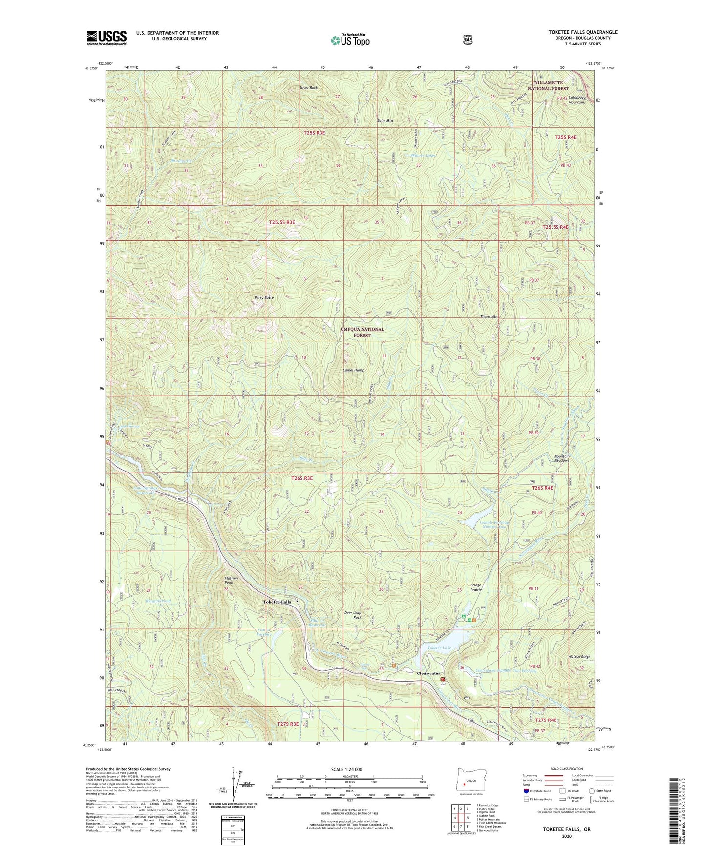
Toketee Falls Oregon US Topo Map
Couldn't load pickup availability
Also explore the Toketee Falls Forest Service Topo of this same quad for updated USFS data
2024 topographic map quadrangle Toketee Falls in the state of Oregon. Scale: 1:24000. Based on the newly updated USGS 7.5' US Topo map series, this map is in the following counties: Douglas. The map contains contour data, water features, and other items you are used to seeing on USGS maps, but also has updated roads and other features. This is the next generation of topographic maps. Printed on high-quality waterproof paper with UV fade-resistant inks.
Quads adjacent to this one:
West: Illahee Rock
Northwest: Reynolds Ridge
North: Staley Ridge
Northeast: Rigdon Point
East: Potter Mountain
Southeast: Garwood Butte
South: Fish Creek Desert
Southwest: Twin Lakes Mountain
This map covers the same area as the classic USGS quad with code o43122c4.
Contains the following named places: Balm Mountain, Boulder Creek Trail, Boulder Creek Wilderness, Bradley Trail, Bridge Prairie, Camel Hump, Cinder Prairie, Cinder Prairie Lookout, Cinder Prairie Way, Clearwater, Clearwater Number Two Forebay, Clearwater Powerplant Number 2, Clearwater River, Crest II Emergency Medical Services, Deer Creek, Deer Leap Rock, Diamond Lake Ranger Station, Fish Creek, Fish Creek Forebay, Fish Creek Powerplant, Flatiron Point, Lemolo Forebay Number Two, Lemolo Powerplant Number 2, Lemolo Two Forebay Recreation Site, Medicine Creek, Mill Creek, Mountain Meadows, Mountain Meadows Trail, Pacificorp Toketee Village Water Treatment Plant, Perry Butte, Perry Butte Way, Pie Creek, Pig Iron Lookout, Ringtail Pine, Ringtail Pond, Skipper Lakes, Slide Creek, Slide Creek Dam, Slide Creek Powerplant, Slide Creek Reservoir, Sliver Rock, Soda Springs, Soda Springs Dam, Soda Springs Reservoir, Spring Creek, Thorn Creek, Thorn Mountain, Toketee Dam, Toketee Falls, Toketee Falls Elementary School, Toketee Falls Post Office, Toketee Lake, Toketee Powerplant, Toketee Recreation Site, Toketee Resevior Boat Ramp, United States Forest Service - Diamond Lake Ranger District, Watson Creek