MyTopo
Sage Hen Butte Oregon US Topo Map
Couldn't load pickup availability
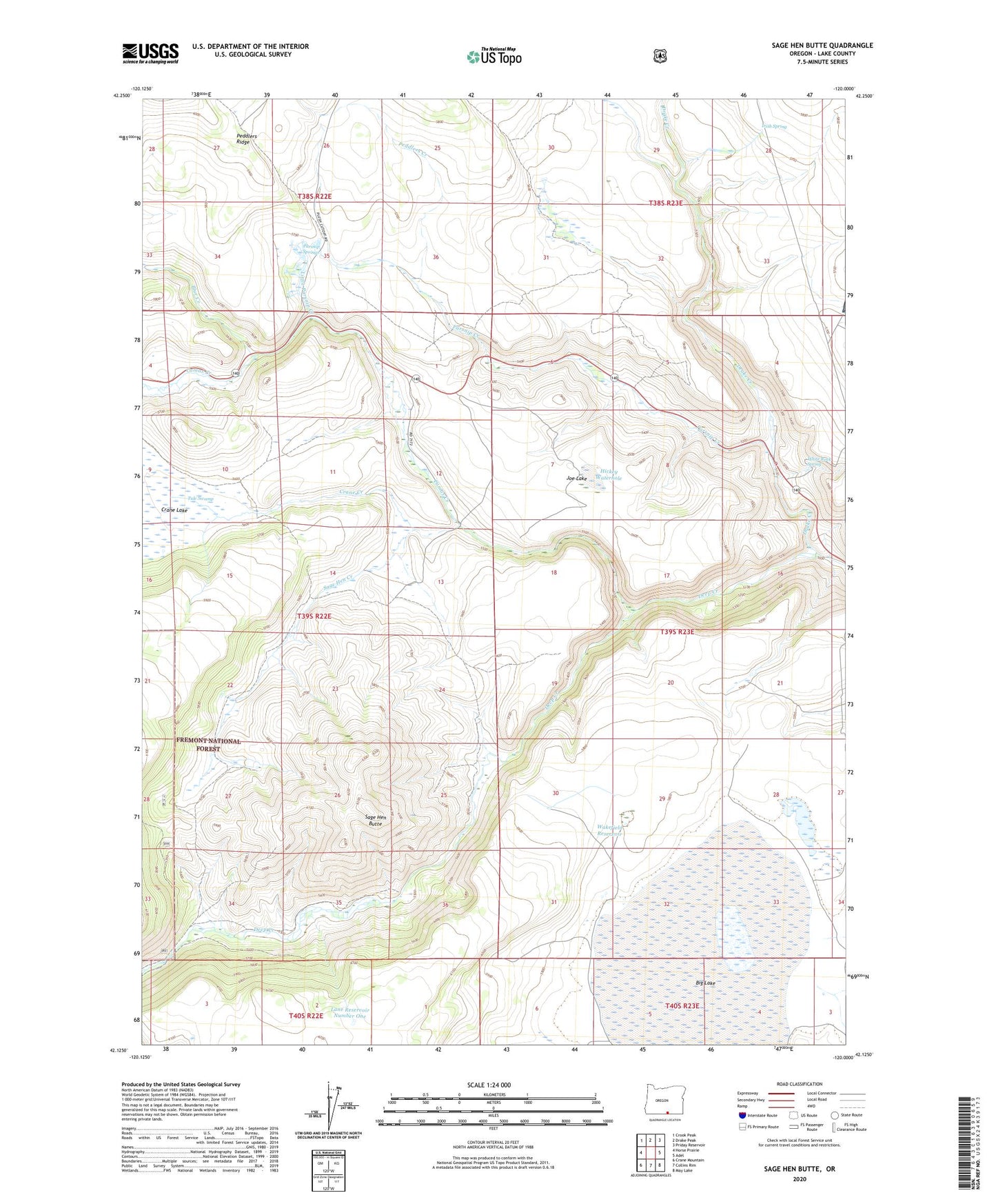
2020 topographic map quadrangle Sage Hen Butte in the state of Oregon. Scale: 1:24000. Based on the newly updated USGS 7.5' US Topo map series, this map is in the following counties: Lake. The map contains contour data, water features, and other items you are used to seeing on USGS maps, but also has updated roads and other features. This is the next generation of topographic maps. Printed on high-quality waterproof paper with UV fade-resistant inks.
Quads adjacent to this one:
West: Horse Prairie
Northwest: Crook Peak
North: Drake Peak
Northeast: Priday Reservoir
East: Adel
Southeast: May Lake
South: Collins Rim
Southwest: Crane Mountain
Contains the following named places: Big Lake, Big Reservoir, Blue Creek, Camas Creek, Crane Creek, Drake Creek, Hickey Waterhole, Irish Spring, Joe Lake, Lane Reservoir Number One, Limburger Cabin, Little Parsnip Creek, Parsnip Creek, Parsnip Springs, Peddlers Creek, Sage Hen Butte, Sage Hen Creek, Sage Hen Crossing, Schadler Cow Camp, Thompson Cabin, Tule Swamp, Wakefield Cabin, Wakefield Reservoir, White Rock Spring