MyTopo
Saint Paul Oregon US Topo Map
Couldn't load pickup availability
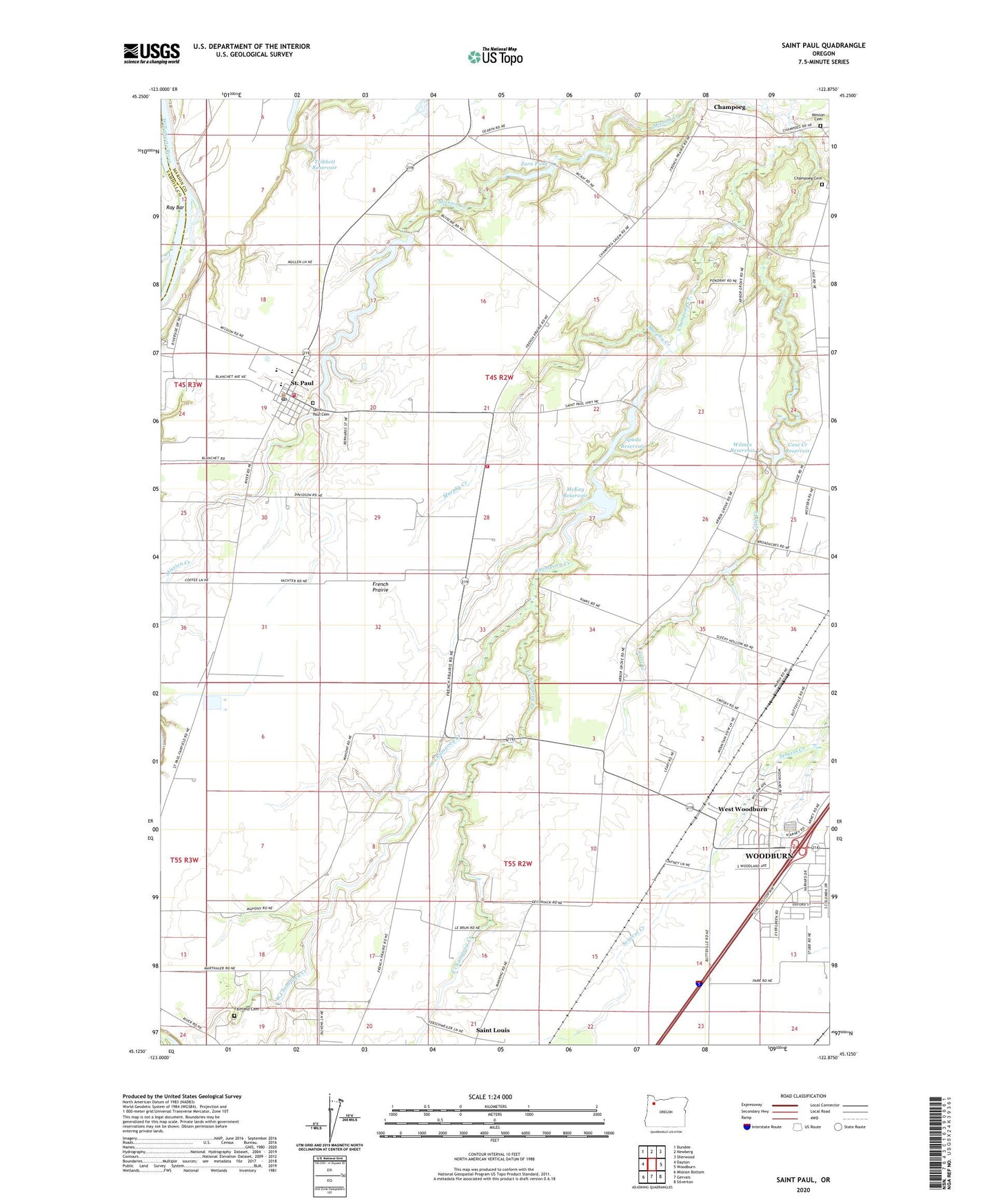
2020 topographic map quadrangle Saint Paul in the state of Oregon. Scale: 1:24000. Based on the newly updated USGS 7.5' US Topo map series, this map is in the following counties: Marion, Yamhill. The map contains contour data, water features, and other items you are used to seeing on USGS maps, but also has updated roads and other features. This is the next generation of topographic maps. Printed on high-quality waterproof paper with UV fade-resistant inks.
Quads adjacent to this one:
West: Dayton
Northwest: Dundee
North: Newberg
Northeast: Sherwood
East: Woodburn
Southeast: Silverton
South: Gervais
Southwest: Mission Bottom
Contains the following named places: Art McKay Dam, Burlingham Park, Case Creek, Case Creek Dam Number One, Case Creek Reservoir, Champoeg, Champoeg Cemetery, Champoeg Post Office, City of Saint Paul, Crosby Reservoir, East Champoeg Creek, Fairfield Cemetery, Foise, French Prairie, Loganville, McKay Reservoir, Mission Creek, Mission Creek Dam, Mission Creek Reservoir, Mission Landing, Murphy Creek, Newellsville, Newellsville Post Office, Oregon State Fish Hatchery, Ray Bar, Rays Landing, Saint Louis School, Saint Paul, Saint Paul Catholic Church, Saint Paul Cemetery, Saint Paul City Hall, Saint Paul Division, Saint Paul Fire District Headquarters, Saint Paul Fire District Substation, Saint Paul High School, Saint Paul Parochial School, Saint Paul Post Office, Saint Paul Public Works Department Office, Saint Paul Rodeo, Saint Paul Sewage Treatment Plant, Scollard, Senecal Creek Greenway, Spada Dam, Spada Reservoir, Tribbett Reservoir, West Champoeg Creek, West Woodburn, West Woodburn Post Office, Weston Cemetery, Wilmes Reservoir, Woodburn Division, Woodburn Dragstrip, Yamhill River, Zorn Pond, ZIP Code: 97137