MyTopo
Gervais Oregon US Topo Map
Couldn't load pickup availability
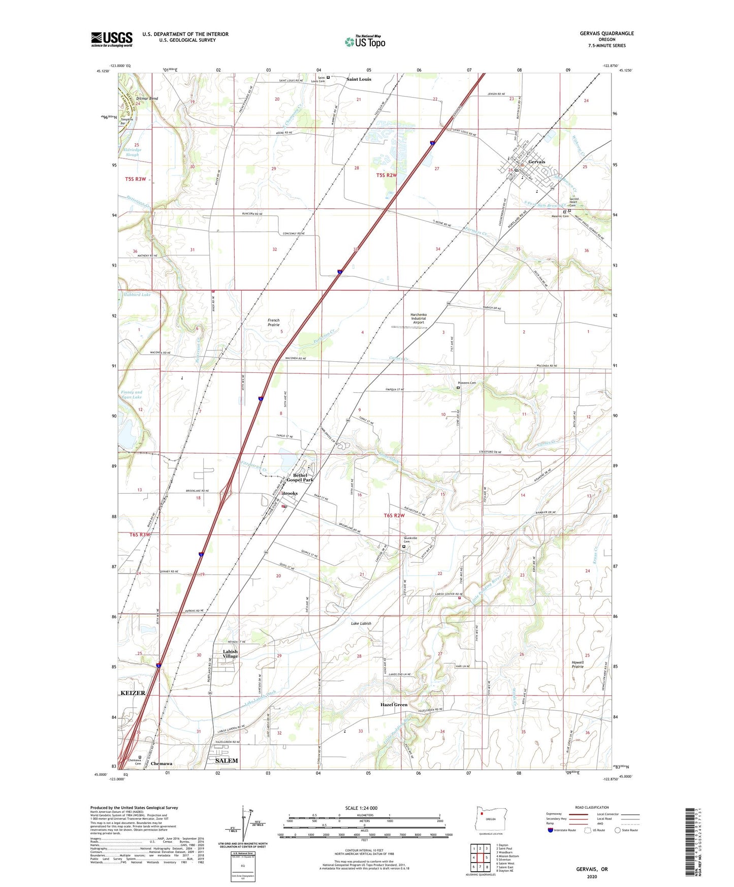
2024 topographic map quadrangle Gervais in the state of Oregon. Scale: 1:24000. Based on the newly updated USGS 7.5' US Topo map series, this map is in the following counties: Marion, Yamhill. The map contains contour data, water features, and other items you are used to seeing on USGS maps, but also has updated roads and other features. This is the next generation of topographic maps. Printed on high-quality waterproof paper with UV fade-resistant inks.
Quads adjacent to this one:
West: Mission Bottom
Northwest: Dayton
North: Saint Paul
Northeast: Woodburn
East: Silverton
Southeast: Stayton NE
South: Salem East
Southwest: Salem West
This map covers the same area as the classic USGS quad with code o45122a8.
Contains the following named places: Anderson Airfield, Beilke Family Farm, Bethel Gospel Park, Blue Star Safety Rest Area, Brooks, Brooks Census Designated Place, Brooks Elementary School, Brooks Post Office, Buena Crest School, Carnes Creek, Chemawa, Chemawa Cemetery, Chemawa Post Office, Chemawa Substation, Chemeketa - Brooks Regional Training Center, City of Gervais, Concomly, Covanta Marion Biomass Facility, Ditmar Bend, Douglas Avenue Alternative School, Eldriedge Elementary School, Eldriedge School, Eldriedge Slough, Fairfield Grange, Finney and Egan Lake, Fitzpatrick Creek, Gervais, Gervais City Hall, Gervais High School, Gervais Middle School, Gervais Municipal Court, Gervais Police Department, Gervais Post Office, Gervais Sewage Treatment Plant, Hazel Green, Hazel Green Elementary School, Hollin Airport, Hopmere, Jones Ditch, Labish Center, Labish Center School, Labish Village, Labish Village Census Designated Place, Lake Labish, Lake Labish County Park, Lake Labish Ditch, Lake Labish Elementary School, Marion County Fire District 1 Station 5 Brooklake, Marion County Fire District 1 Station 7 Labish Center, Masonic Cemetery, Ogden Martin Systems of Marion, Pioneer Alternative Center, Pioneers Cemetery, Sacred Heart Catholic Church, Sacred Heart Cemetery, Sacred Heart Elementary School, Saint Louis, Saint Louis Cemetery, Saint Louis Fish Ponds County Park, Saint Louis Post Office, Saint Louis Station, Salem Keizer Volcanoes Stadium, Skunkville, Skunkville Cemetery, Smith Private Airport, South Fork Sam Brown Creek, Tompkins Bar, Waconda, Waconda Post Office, Western Helicopter Services Airport, Willamette Valley Christian School, Woodburn Rural Fire Protection District Station 24 Waconda, ZIP Codes: 97026, 97305