MyTopo
Schott Canyon Oregon US Topo Map
Couldn't load pickup availability
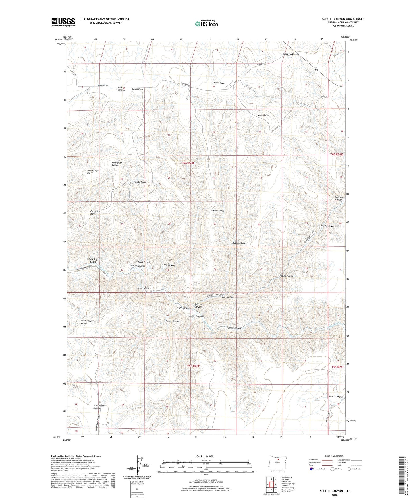
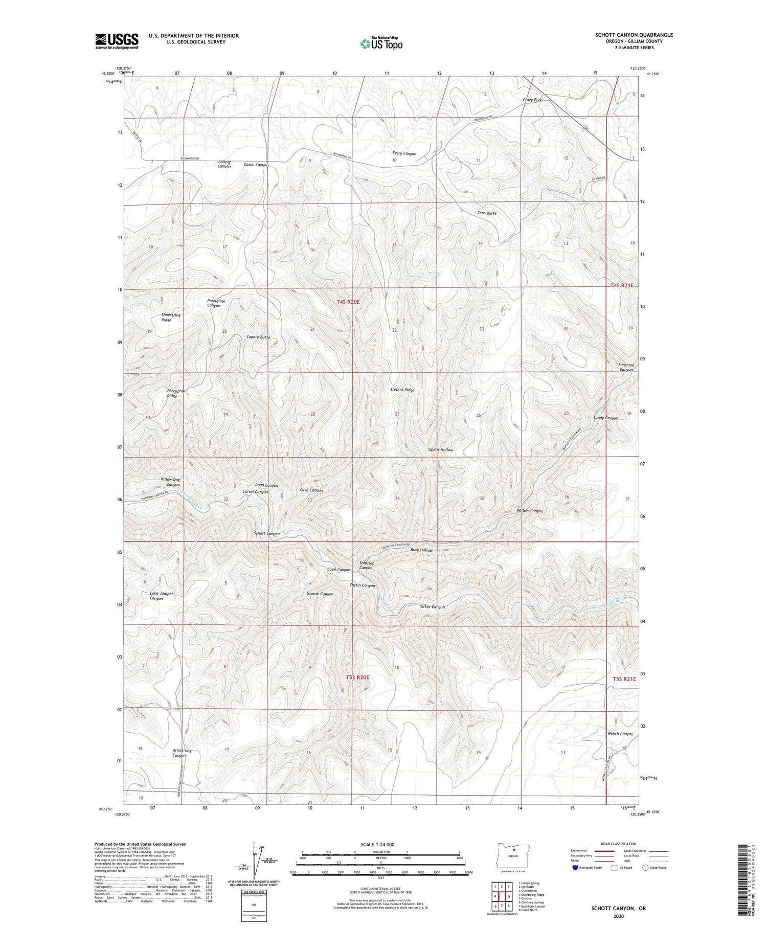
2020 topographic map quadrangle Schott Canyon in the state of Oregon. Scale: 1:24000. Based on the newly updated USGS 7.5' US Topo map series, this map is in the following counties: Gilliam. The map contains contour data, water features, and other items you are used to seeing on USGS maps, but also has updated roads and other features. This is the next generation of topographic maps. Printed on high-quality waterproof paper with UV fade-resistant inks.
Quads adjacent to this one:
West: Shoestring Ridge
Northwest: Indian Spring
North: Igo Butte
Northeast: Gwendolen
East: Condon
Southeast: Fossil North
South: Buckhorn Canyon
Southwest: Chimney Springs
Contains the following named places: Buck Hollow, Cameron School, Cave Canyon, Coffin Canyon, Condon Air Force Station, Cope Canyon, Corral Canyon, Coyote Butte, Grouse Canyon, Porcupine Ridge, Road Canyon, Sandy Canyon, Schott Canyon, Sniption Canyon, Squaw Hollow, Stebins Ridge, Sunshine Canyon, Tucker Canyon, Willow Canyon, Yellow Dog Canyon, Zero Butte