MyTopo
Scottsburg Oregon US Topo Map
Couldn't load pickup availability
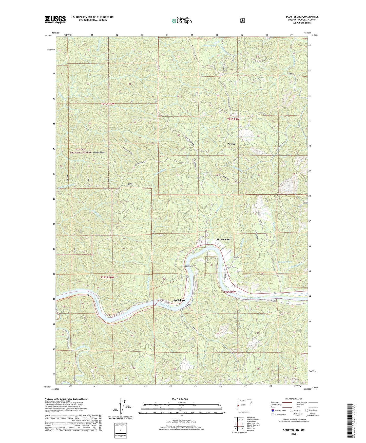
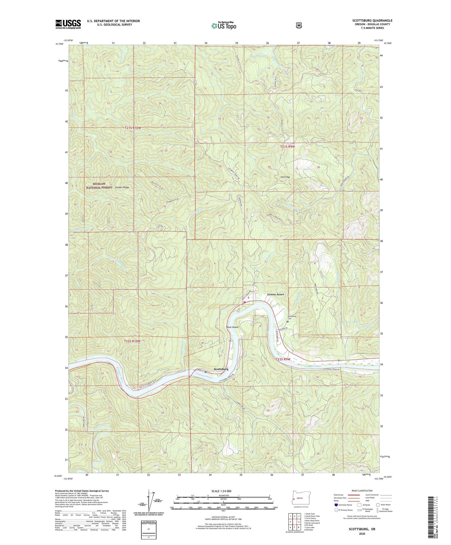
2020 topographic map quadrangle Scottsburg in the state of Oregon. Scale: 1:24000. Based on the newly updated USGS 7.5' US Topo map series, this map is in the following counties: Douglas. The map contains contour data, water features, and other items you are used to seeing on USGS maps, but also has updated roads and other features. This is the next generation of topographic maps. Printed on high-quality waterproof paper with UV fade-resistant inks.
Quads adjacent to this one:
West: Deer Head Point
Northwest: North Fork
North: Smith River Falls
Northeast: Twin Sisters
East: Devils Graveyard
Southeast: Old Blue
South: Loon Lake
Southwest: Elk Peak
Contains the following named places: Burchard Creek, Burchard Lake, Fern Top, Footlog Creek, Golden Creek, Golden Ridge, Green Acres, Little Mill Creek, Mill Creek, Murphys Camp, Myrtle City Post Office, Purdy Creek, Rock Island, Scottsburg, Scottsburg Cemetery, Scottsburg County Park Boat Ramp, Scottsburg Park, Scottsburg Post Office, Scottsburg Rural Fire Protection District, Umpqua River Safety Rest Area, Wasson Lake, Wells Creek, ZIP Code: 97473