MyTopo
Twin Sisters Oregon US Topo Map
Couldn't load pickup availability
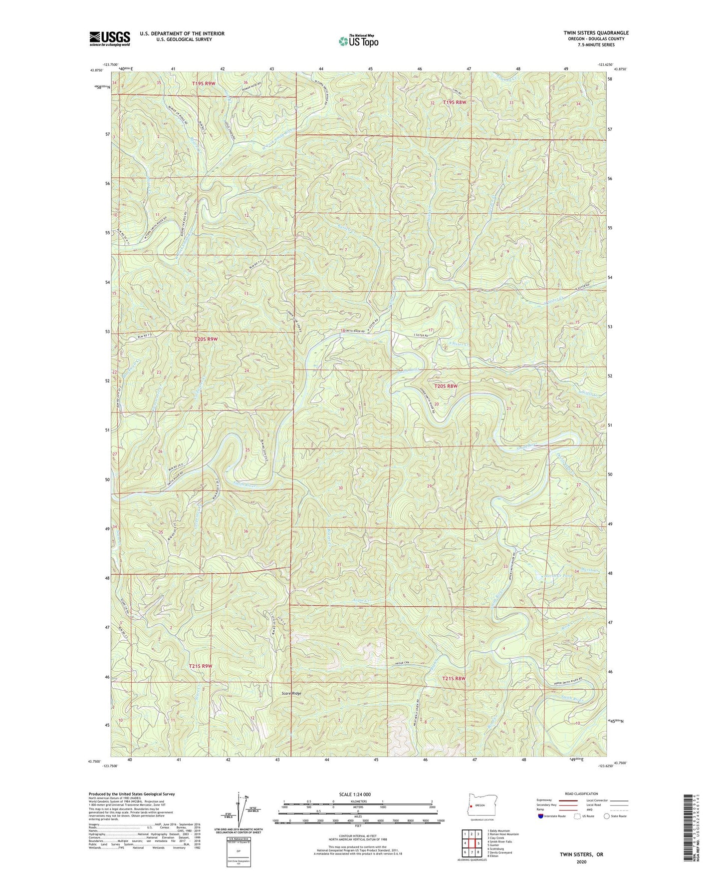
2023 topographic map quadrangle Twin Sisters in the state of Oregon. Scale: 1:24000. Based on the newly updated USGS 7.5' US Topo map series, this map is in the following counties: Douglas. The map contains contour data, water features, and other items you are used to seeing on USGS maps, but also has updated roads and other features. This is the next generation of topographic maps. Printed on high-quality waterproof paper with UV fade-resistant inks.
Quads adjacent to this one:
West: Smith River Falls
Northwest: Baldy Mountain
North: Roman Nose Mountain
Northeast: Clay Creek
East: Gunter
Southeast: Elkton
South: Devils Graveyard
Southwest: Scottsburg
This map covers the same area as the classic USGS quad with code o43123g6.
Contains the following named places: Argue Creek, Beaver Creek, Big Creek, Blind Creek, Carpenter Creek, Coldwater Creek, Damewoods Place, Devils Club Creek, Gold Creek, Herb Creek, Hess Ranch, Marsh Creek, Marsh Creek Pond, Moore Creek, Mosetown Creek, North Sister Creek, Oxbow Burn, Rock Creek, Russell Creek, Scare Ridge Lookout, South Sister Creek, Sweden Creek, Twin Sisters, Twin Sisters Trail