MyTopo
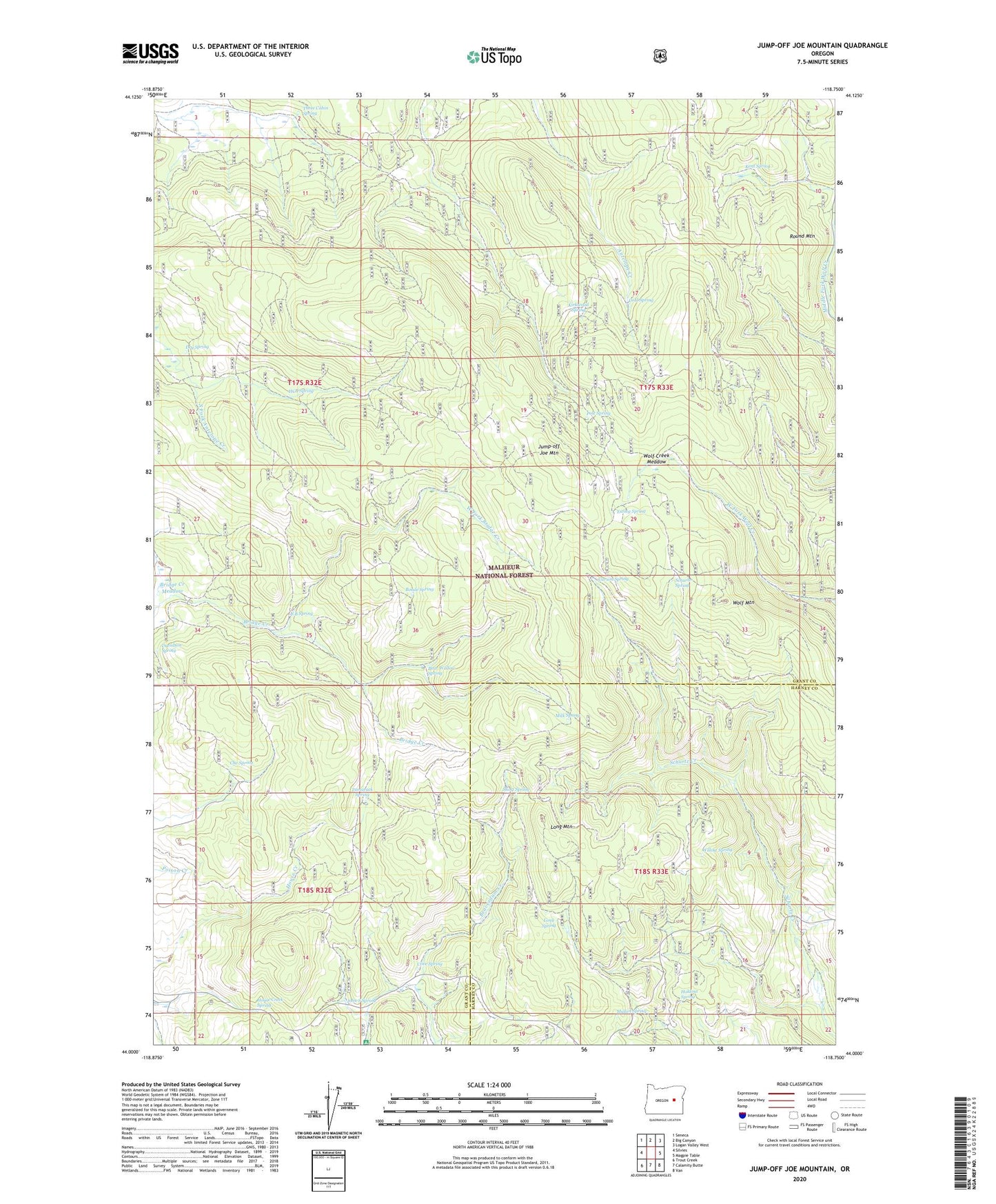
Jump-off Joe Mountain Oregon US Topo Map
Couldn't load pickup availability
Also explore the Jump-off Joe Mountain Forest Service Topo of this same quad for updated USFS data
2023 topographic map quadrangle Jump-off Joe Mountain in the state of Oregon. Scale: 1:24000. Based on the newly updated USGS 7.5' US Topo map series, this map is in the following counties: Grant, Harney. The map contains contour data, water features, and other items you are used to seeing on USGS maps, but also has updated roads and other features. This is the next generation of topographic maps. Printed on high-quality waterproof paper with UV fade-resistant inks.
Quads adjacent to this one:
West: Silvies
Northwest: Seneca
North: Big Canyon
Northeast: Logan Valley West
East: Magpie Table
Southeast: Van
South: Calamity Butte
Southwest: Trout Creek
Contains the following named places: Bear Wallow Spring, Bonde Spring, Bridge Creek Meadow, Carson Spring, Che Spring, Cold Spring, Cove Spring, Cove Spring Work Center, Davidson Spring, Dry Spring, Ewing Spring, HCB Spring, Holdout Spring, Hopper Ranch, House Creek Spring, John S Spring, Jump-off Joe Mountain, Kent Spring, Kirkwood Spring, Long Mountain, Long Spring, Milk Spring, Mullen Spring, Pole Spring, Round Mountain, S B Spring, Schurtz Spring, Short Spring, Tamarack Spring, Tamarack Spring Camp, Three Cabin Spring, West Fork Bridge Creek, Willow Spring, Wolf Creek Meadow, Wolf Mountain