MyTopo
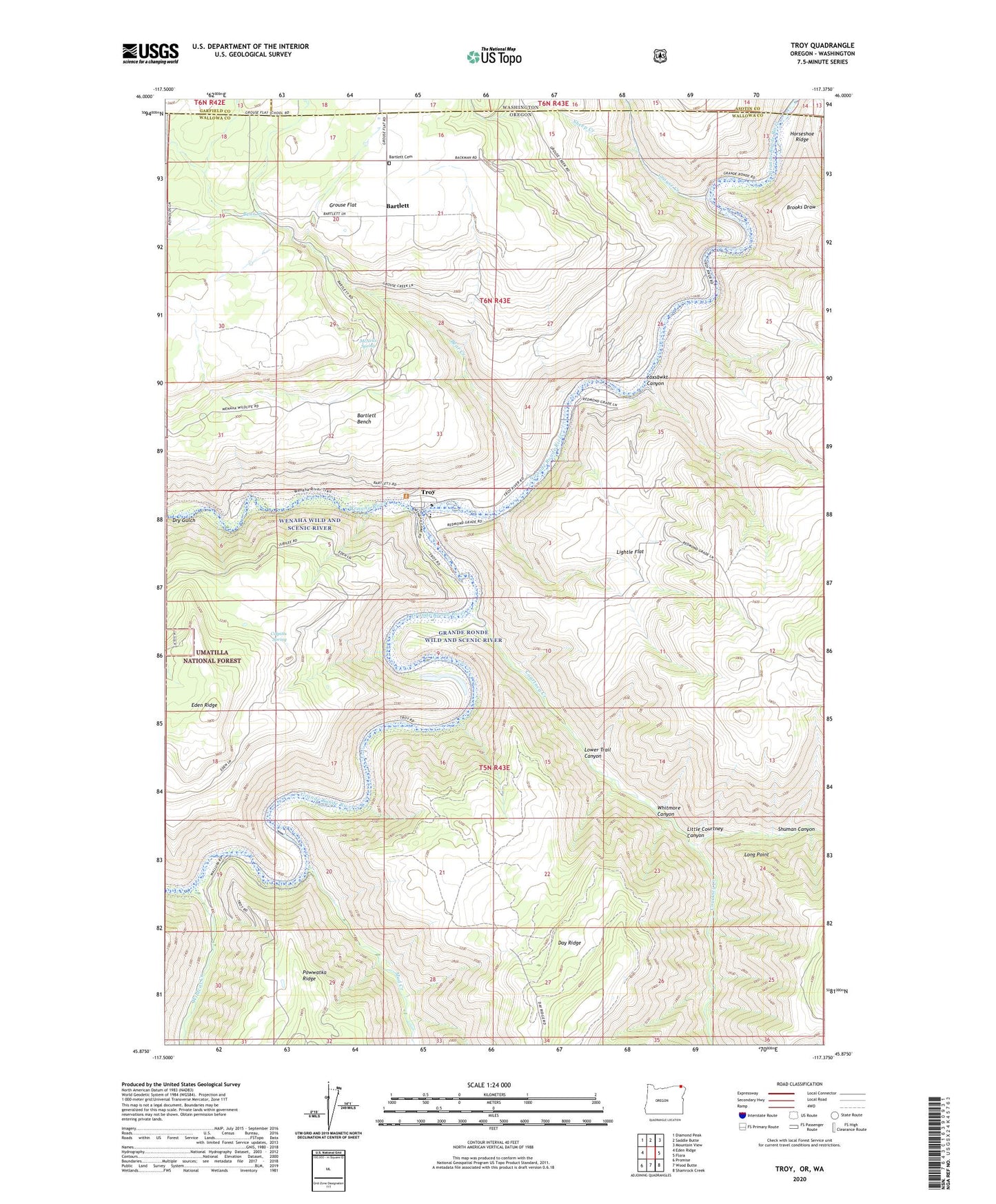
Troy Oregon US Topo Map
Couldn't load pickup availability
Also explore the Troy Forest Service Topo of this same quad for updated USFS data
2023 topographic map quadrangle Troy in the state of Oregon. Scale: 1:24000. Based on the newly updated USGS 7.5' US Topo map series, this map is in the following counties: Wallowa, Asotin, Garfield. The map contains contour data, water features, and other items you are used to seeing on USGS maps, but also has updated roads and other features. This is the next generation of topographic maps. Printed on high-quality waterproof paper with UV fade-resistant inks.
Quads adjacent to this one:
West: Eden Ridge
Northwest: Diamond Peak
North: Saddle Butte
Northeast: Mountain View
East: Flora
Southeast: Shamrock Creek
South: Wood Butte
Southwest: Promise
Contains the following named places: Bartlett, Bartlett Bench, Bartlett Cemetery, Bartlett Post Office, Bear Creek, Colpitts Spring, Courtney Creek, Dry Gulch, Grouse, Grouse Creek, Grouse Flat, Grouse Post Office, Horseshoe Ridge, Lightle Flat, Little Courtney Canyon, Long Point, Lower Trail Canyon, Lyman Post Office, McNeils Spring, Mud Creek, Mud Creek Boat Launch, Powwatka, Powwatka Post Office, Sheep Creek, Shuman Canyon, Taxsawkt Canyon, Troy, Troy Boat Access 1, Troy Boat Access 2, Troy Post Office, United State Fish and Wildlife River Testing Site, Wallowa County Branch Library Troy Elementary School, Wenaha River, Whitmore Canyon, Wildcat Creek, Wildcat Creek Boat Access