MyTopo
Shitike Butte Oregon US Topo Map
Couldn't load pickup availability
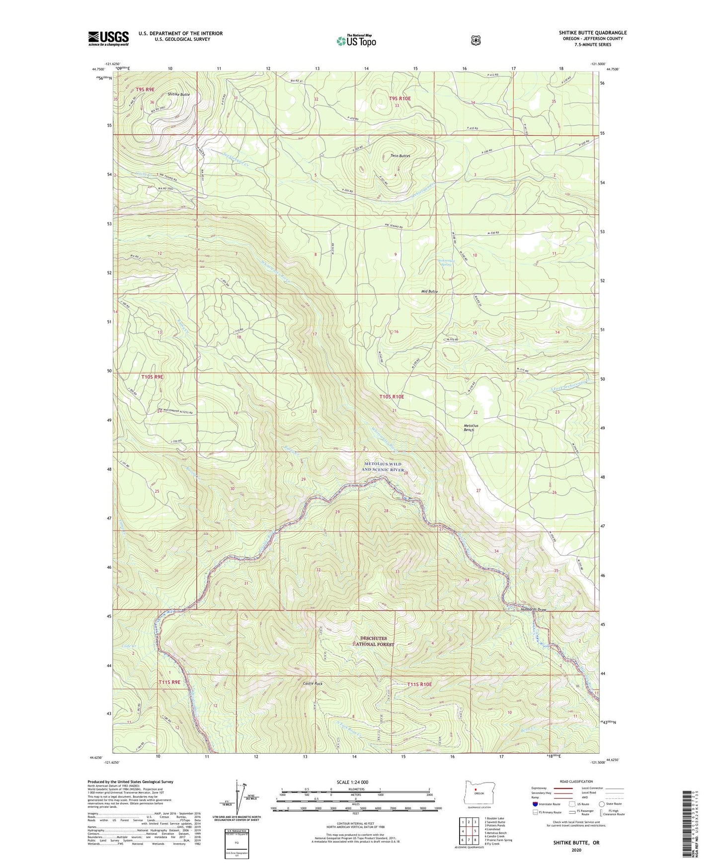
2020 topographic map quadrangle Shitike Butte in the state of Oregon. Scale: 1:24000. Based on the newly updated USGS 7.5' US Topo map series, this map is in the following counties: Jefferson. The map contains contour data, water features, and other items you are used to seeing on USGS maps, but also has updated roads and other features. This is the next generation of topographic maps. Printed on high-quality waterproof paper with UV fade-resistant inks.
Quads adjacent to this one:
West: Lionshead
Northwest: Boulder Lake
North: Sawmill Butte
Northeast: Potters Ponds
East: Metolius Bench
Southeast: Fly Creek
South: Prairie Farm Spring
Southwest: Candle Creek
Contains the following named places: Alder Spring Lookout, Cache Creek, Camp Creek, Castle Rock, Code Creek, Hubbards Draw, Middle Butte, Racing Creek, Rainy Creek, Seekseequa Spring, Shitike Butte, Shitike Butte Lookout Station, Twin Buttes, Whitewater River