MyTopo
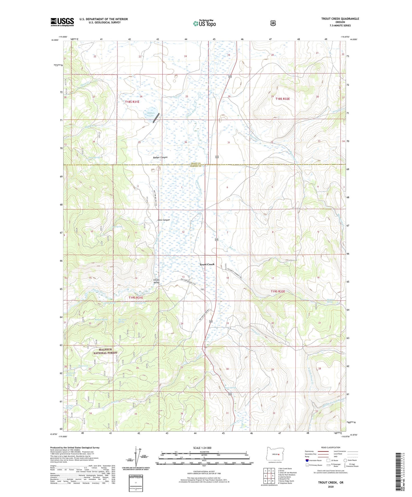
Trout Creek Oregon US Topo Map
Couldn't load pickup availability
Also explore the Trout Creek Forest Service Topo of this same quad for updated USFS data
2023 topographic map quadrangle Trout Creek in the state of Oregon. Scale: 1:24000. Based on the newly updated USGS 7.5' US Topo map series, this map is in the following counties: Harney, Grant. The map contains contour data, water features, and other items you are used to seeing on USGS maps, but also has updated roads and other features. This is the next generation of topographic maps. Printed on high-quality waterproof paper with UV fade-resistant inks.
Quads adjacent to this one:
West: Myrtle Park Meadows
Northwest: Rail Creek Butte
North: Silvies
Northeast: Jump-off Joe Mountain
East: Calamity Butte
Southeast: Telephone Butte
South: Devine Ridge North
Southwest: Mosquito Flat
This map covers the same area as the classic USGS quad with code o43118h8.
Contains the following named places: Badger Canyon, Big Trees Spring, Buffalo Dam, Buffalo Lake, Camp Creek, Craddock Ranch, Curry Spring, Deadwood Spring, Dog Creek, Fuqua Creek, Hall Creek, Loco Canyon, Loco Spring, Log Pipe Spring, Lost Creek, Maitland Spring, Middle Fork Trout Creek, Mountain Creek, Newell Creek, Owen Spring, Purdy Ranch, Ranger Spring, Roper Spring, Scheckels Dam, Scheckels Reservoir, Sherwood Lake, Silvies Valley, Silvies Valley Ranch, Smith Spring, Thorn Creek, Trout Creek, West Side Ditch