MyTopo
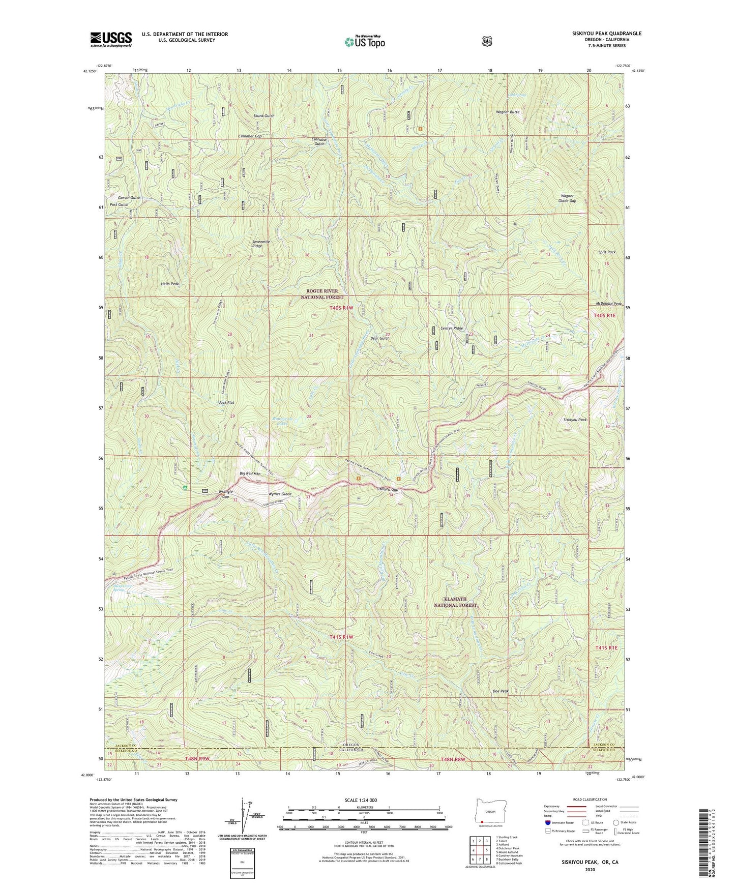
Siskiyou Peak Oregon US Topo Map
Couldn't load pickup availability
Also explore the Siskiyou Peak Forest Service Topo of this same quad for updated USFS data
2023 topographic map quadrangle Siskiyou Peak in the state of Oregon. Scale: 1:24000. Based on the newly updated USGS 7.5' US Topo map series, this map is in the following counties: Jackson, Siskiyou. The map contains contour data, water features, and other items you are used to seeing on USGS maps, but also has updated roads and other features. This is the next generation of topographic maps. Printed on high-quality waterproof paper with UV fade-resistant inks.
Quads adjacent to this one:
West: Dutchman Peak
Northwest: Sterling Creek
North: Talent
Northeast: Ashland
East: Mount Ashland
Southeast: Cottonwood Peak
South: Buckhorn Bally
Southwest: Condrey Mountain
This map covers the same area as the classic USGS quad with code o42122a7.
Contains the following named places: Bear Gulch, Big Red Mountain, Big Red Mountain Creek, Center Ridge, Cinnabar Gap, Cinnabar Gulch, Cold Spring, Corral Creek, Doe Peak, Freezeout Cabin, Garvin Gulch, Greely Creek, Hells Peak, Hendricks Creek, Jack Creek, Jack Flat, Jim Creek, Lake Creek, Little Red Mountain Creek, Long John Creek, McDonald Creek, McDonald Ditch, McDonald Peak, Monogram Lakes, North Fork Greely Creek, Post Gulch, Sevenmile Ridge, Sheep Camp Spring, Sheep Creek, Siskiyou Gap, Siskiyou Peak, Split Rock, Split Rock Creek, Wagner Butte, Wagner Glade Gap, West Branch Long John Creek, Wrangle Creek, Wrangle Gap, Wrangle Recreation Site, Wymer Glade