MyTopo
Sterling Creek Oregon US Topo Map
Couldn't load pickup availability
Also explore the Sterling Creek Forest Service Topo of this same quad for updated USFS data
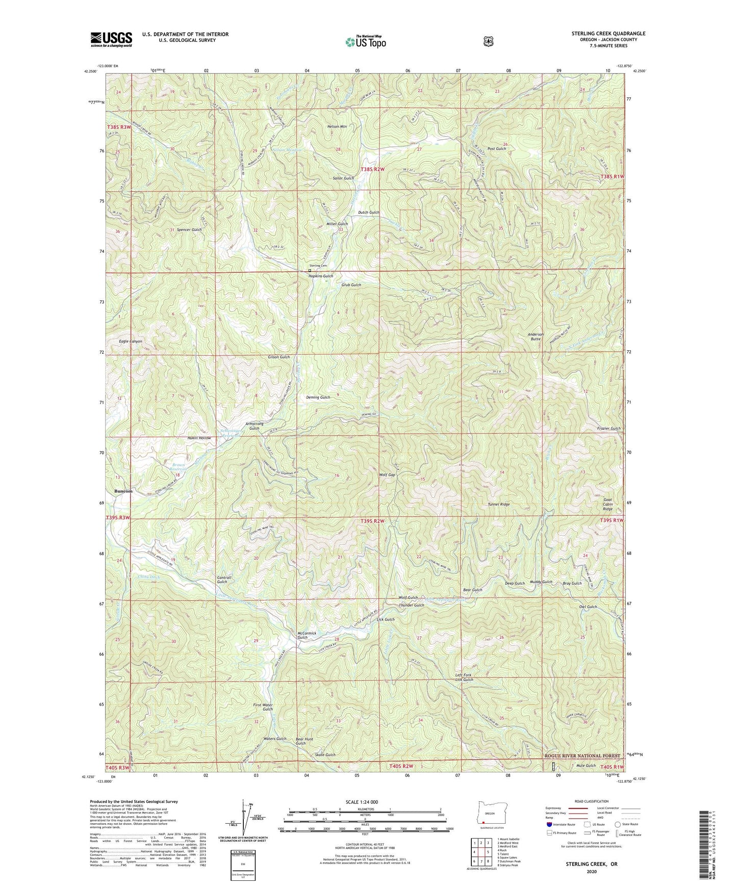
2023 topographic map quadrangle Sterling Creek in the state of Oregon. Scale: 1:24000. Based on the newly updated USGS 7.5' US Topo map series, this map is in the following counties: Jackson. The map contains contour data, water features, and other items you are used to seeing on USGS maps, but also has updated roads and other features. This is the next generation of topographic maps. Printed on high-quality waterproof paper with UV fade-resistant inks.
Quads adjacent to this one:
West: Ruch
Northwest: Mount Isabelle
North: Medford West
Northeast: Medford East
East: Talent
Southeast: Siskiyou Peak
South: Dutchman Peak
Southwest: Squaw Lakes
This map covers the same area as the classic USGS quad with code o42122b8.
Contains the following named places: Anderson Butte, Anderson Butte Lookout, Armstrong Gulch, Barr Ranch, Bear Gulch, Bear Hunt Gulch, Birch Creek, Blacksmith Creek, Bray Gulch, Brown Reservoir, Buncom, Buncom Post Office, Cantrall Gulch, Cass Ranch, Crump, Deep Gulch, Deming Gulch, Dutch Gulch, First Water Gulch, Gilson Gulch, Goat Cabin Ridge, Grouse Creek, Grub Gulch, Hopkins Gulch, Hukill Hollow, Left Fork Lick Gulch, Lick Gulch, Little Applegate Recreation Site, Little Lick Creek, McCormick Gulch, Miller Gulch, Muddy Gulch, Nelson Meadow, Nelson Mountain, Owl Gulch, Post Gulch, Rush Creek, Sailor Gulch, Schlesinger Reservoir, Skate Gulch, Sleppy Mine, Southwest Jackson Division, Sterling Cemetery, Sterling Creek, Sterling Ditch, Sterlingville Post Office, Thunder Gulch, Trickle Creek, Tunnel Ridge, Tunnel Ridge Recreation Site, Waters Gulch, Wolf Gap, Wolf Gulch, Yale Creek