MyTopo
Skeleton Mountain Oregon US Topo Map
Couldn't load pickup availability
Also explore the Skeleton Mountain Forest Service Topo of this same quad for updated USFS data
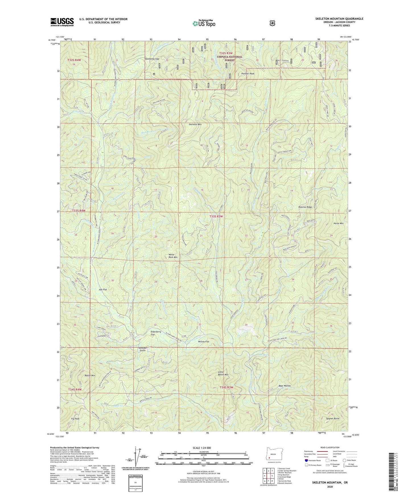
2023 topographic map quadrangle Skeleton Mountain in the state of Oregon. Scale: 1:24000. Based on the newly updated USGS 7.5' US Topo map series, this map is in the following counties: Jackson. The map contains contour data, water features, and other items you are used to seeing on USGS maps, but also has updated roads and other features. This is the next generation of topographic maps. Printed on high-quality waterproof paper with UV fade-resistant inks.
Quads adjacent to this one:
West: King Mountain
Northwest: Starvout Creek
North: Cedar Springs Mountain
Northeast: Richter Mountain
East: Cleveland Ridge
Southeast: Boswell Mountain
South: McConville Peak
Southwest: Wimer
This map covers the same area as the classic USGS quad with code o42123f1.
Contains the following named places: Angel Camp, Ash Flat, Battle Mountain, Bear Wallow, Cedar Creek, Cold Creek, Elderberry Creek, Elderberry Flat, Elderberry Flat Recreation Site, Fry Peak, Goolaway Gap, Horse Mountain, Lick Creek, Little Battle Mountain, Panther Peak, Peavine Ridge, Right Fork Salt Creek, Rock Creek, Salt Creek, Salt Creek Guard Station, Salt Creek Recreation Site, Salt Spring, Sam Creek, Sand Bar Gulch, Sand Creek, Skeleton Mountain, Slick Rock Creek, Spignet Butte, Steinmetz Creek, Swamp Creek, White Rock Mountain, Willow Flat