MyTopo
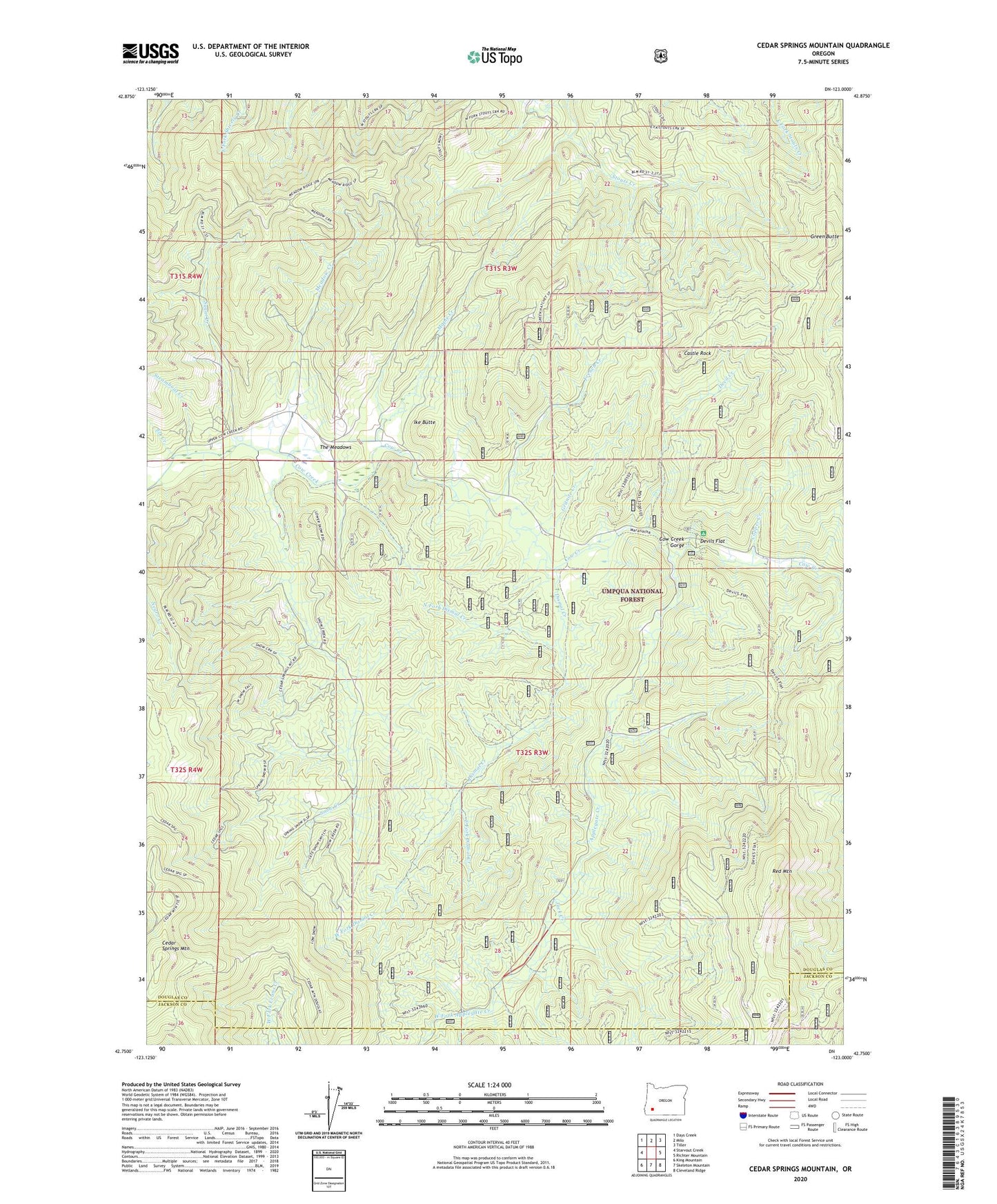
Cedar Springs Mountain Oregon US Topo Map
Couldn't load pickup availability
Also explore the Cedar Springs Mountain Forest Service Topo of this same quad for updated USFS data
2023 topographic map quadrangle Cedar Springs Mountain in the state of Oregon. Scale: 1:24000. Based on the newly updated USGS 7.5' US Topo map series, this map is in the following counties: Douglas, Jackson. The map contains contour data, water features, and other items you are used to seeing on USGS maps, but also has updated roads and other features. This is the next generation of topographic maps. Printed on high-quality waterproof paper with UV fade-resistant inks.
Quads adjacent to this one:
West: Starvout Creek
Northwest: Days Creek
North: Milo
Northeast: Tiller
East: Richter Mountain
Southeast: Cleveland Ridge
South: Skeleton Mountain
Southwest: King Mountain
This map covers the same area as the classic USGS quad with code o42123g1.
Contains the following named places: Anchor School, Applegate Creek, Binger Post Office, Canyon Number Three Trail, Castle Rock, Cedar Springs Mountain, Copper Creek, Cow Creek Gorge, Crater Lake Ski Bowl, Devil Creek, Devils Flat, Devils Flat Guard Station, Devils Flat Recreation Site, Dismal Creek, East Fork Applegate Creek, East Fork Dismal Creek, Elk Creek, French Creek, Granite Creek, Green Butte, Ike Butte, Jack Creek, Koch Ranch, Maple Creek, Meadow Creek, North Fork Dismal Creek, Red Mountain, Red Mountain Trail, Snow Creek, Steamboat Creek, Sugar Creek, The Meadows, West Fork Applegate Creek, West Fork Dismal Creek