MyTopo
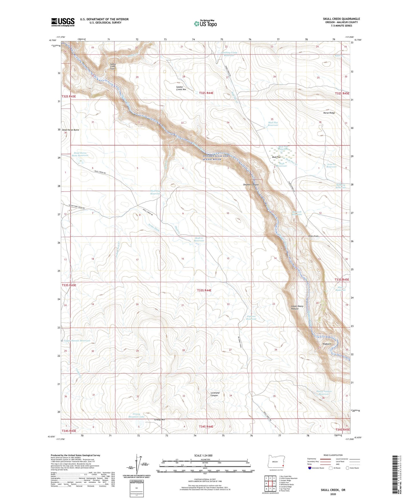
Skull Creek Oregon US Topo Map
Couldn't load pickup availability
2024 topographic map quadrangle Skull Creek in the state of Oregon. Scale: 1:24000. Based on the newly updated USGS 7.5' US Topo map series, this map is in the following counties: Malheur. The map contains contour data, water features, and other items you are used to seeing on USGS maps, but also has updated roads and other features. This is the next generation of topographic maps. Printed on high-quality waterproof paper with UV fade-resistant inks.
Quads adjacent to this one:
West: Indian Fort
Northwest: Dry Creek Rim
North: Little Grassy Mountain
Northeast: Juniper Ridge
East: Whitehorse Butte
Southeast: Three Forks
Southwest: Caviatta Ridge
This map covers the same area as the classic USGS quad with code o42117f3.
Contains the following named places: Dead Horse Butte Reservoir, Deary Pasture Reservoir, Eiguren Reservoir, Grassy Mountain, Grassy Mountain Lake, Halfway Reservoir, Hogback, Horse Ridge, Iron Pit Reservoir, Lambing Camp Reservoir, Lower Deary Pasture, Mud Flat, Mud Flat Reservoir, Mud Flat Waterhole, Owyhee Canyon Overlook, Owyhee Wild and Scenic River, Paus Reservoir, Pedro Trails, Rimrock Reservoir, Rock Reservoir, Scotts Ditch, Skull Cap Reservoir, Skull Creek, Skull Creek Reservoir, Soldier Creek, Soldier Creek Trails, Soldier Creek Vee, Upper Duncan Reservoir