MyTopo
Whitehorse Butte Oregon US Topo Map
Couldn't load pickup availability
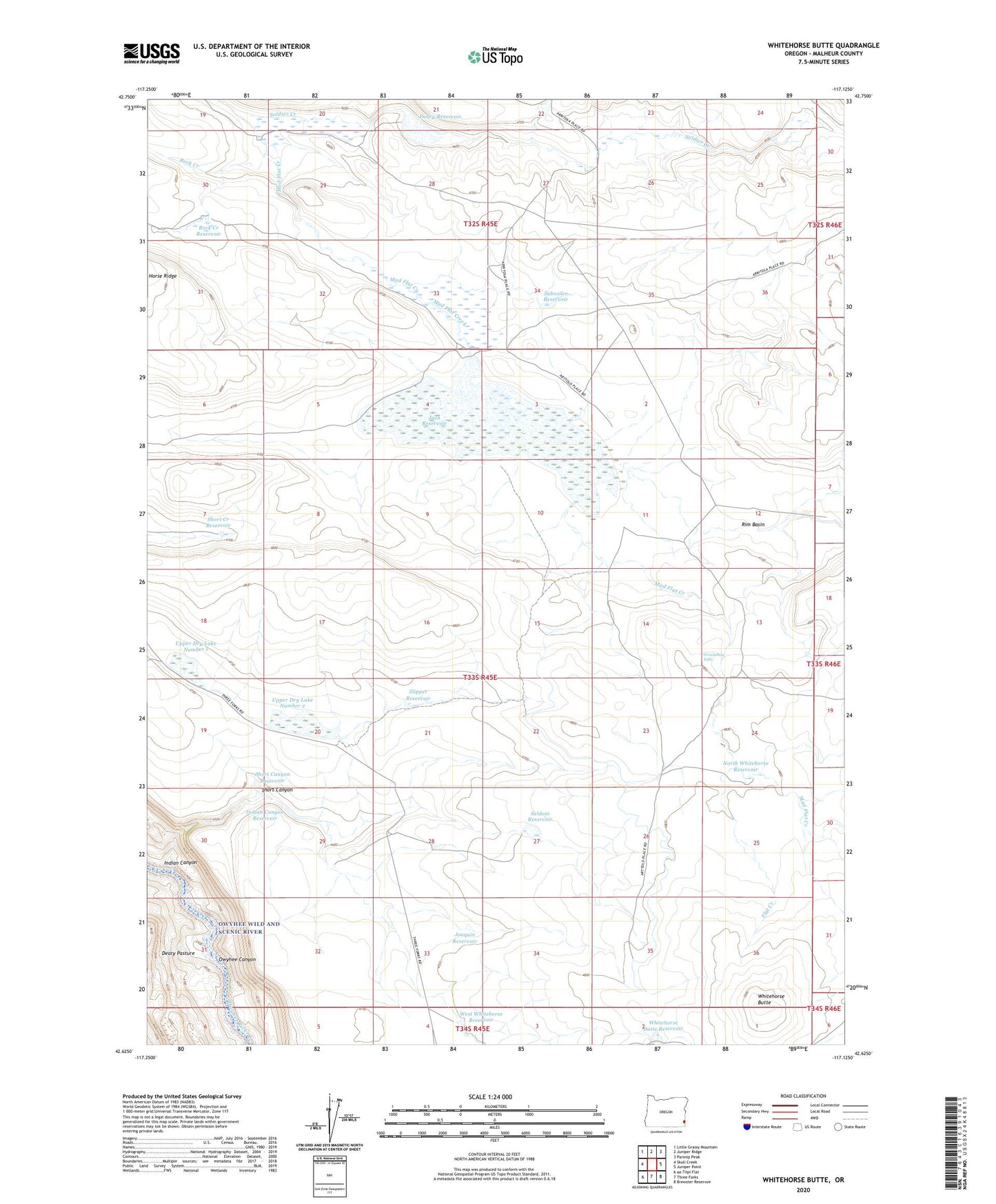
2024 topographic map quadrangle Whitehorse Butte in the state of Oregon. Scale: 1:24000. Based on the newly updated USGS 7.5' US Topo map series, this map is in the following counties: Malheur. The map contains contour data, water features, and other items you are used to seeing on USGS maps, but also has updated roads and other features. This is the next generation of topographic maps. Printed on high-quality waterproof paper with UV fade-resistant inks.
Quads adjacent to this one:
West: Skull Creek
Northwest: Little Grassy Mountain
North: Juniper Ridge
Northeast: Parsnip Peak
East: Juniper Point
Southeast: Brewster Reservoir
South: Three Forks
This map covers the same area as the classic USGS quad with code o42117f2.
Contains the following named places: Arritola Ranch, Deary Dam, Deary Pasture, Deary Reservoir, Flat Creek, Groundhog Falls, Indian Canyon, Indian Canyon Reservoir, Jaca Dam, Jaca Reservoir, Joaquin Reservoir, Mud Flat Creek, North Whitehorse Reservoir, Rim Basin, Rock Creek, Rock Creek Reservoir, Seldom Reservoir, Short Canyon, Short Canyon Reservoir, Short Creek Reservoir, Slipper Reservoir, Spring Branch Creek, Subsoiler Reservoir, Upper Dry Lake Number 1, Upper Dry Lake Number 2, West Whitehorse Reservoir, Whitehorse Butte, Whitehorse Butte Reservoir