MyTopo
Three Forks Oregon US Topo Map
Couldn't load pickup availability
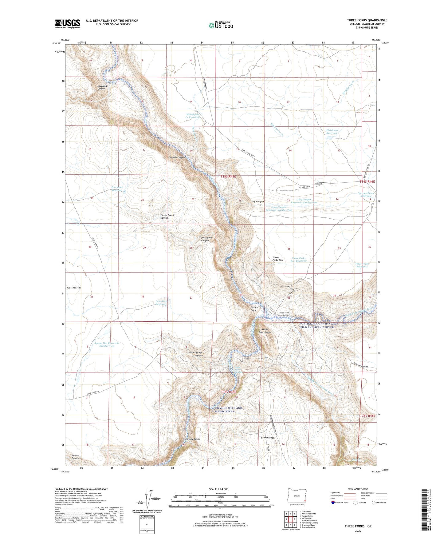
2024 topographic map quadrangle Three Forks in the state of Oregon. Scale: 1:24000. Based on the newly updated USGS 7.5' US Topo map series, this map is in the following counties: Malheur. The map contains contour data, water features, and other items you are used to seeing on USGS maps, but also has updated roads and other features. This is the next generation of topographic maps. Printed on high-quality waterproof paper with UV fade-resistant inks.
Quads adjacent to this one:
Northwest: Skull Creek
North: Whitehorse Butte
Northeast: Juniper Point
East: Brewster Reservoir
Southeast: Deacon Crossing
South: Drummond Basin
Southwest: No Crossing Crossing
This map covers the same area as the classic USGS quad with code o42117e2.
Contains the following named places: Bowdens Post Office, Division Fence Reservoir, Lone Tree Reservoir, Long Canyon, Long Canyon Reservoir Number One, Long Canyon Reservoir Number Two, Loveland Canyon, Middle Fork Owyhee River, Military Grade, North Fork Owyhee River, Pole Creek, Porcupine Canyon, Porcupine Reservoir, Squaw Flat Reservoir Number Two, Three Forks, Three Forks Access Boat Launch, Three Forks Dome, Three Forks Reservoir, Three Forks Rim, Three Forks Rim Reservoir, Toppin Creek Canyon, Tudor Warm Springs, Tuu-Tiipi Flat, Warm Springs Canyon, Whiskey Gulch, Whitehorse Creek, Whitehorse Creek Reservoir, Whitehorse Reservoir