MyTopo
Sparta Butte Oregon US Topo Map
Couldn't load pickup availability
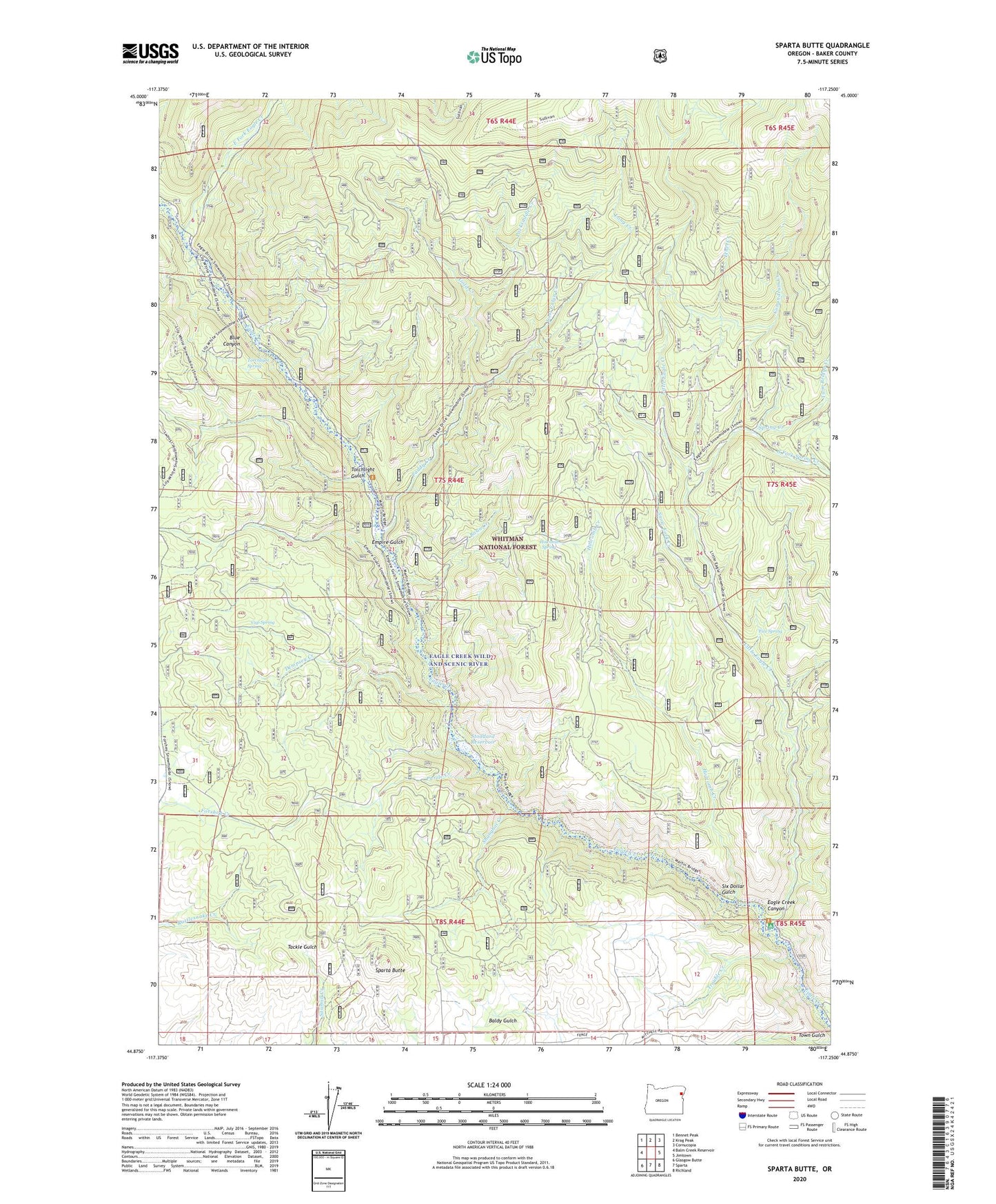
2020 topographic map quadrangle Sparta Butte in the state of Oregon. Scale: 1:24000. Based on the newly updated USGS 7.5' US Topo map series, this map is in the following counties: Baker. The map contains contour data, water features, and other items you are used to seeing on USGS maps, but also has updated roads and other features. This is the next generation of topographic maps. Printed on high-quality waterproof paper with UV fade-resistant inks.
Quads adjacent to this one:
West: Balm Creek Reservoir
Northwest: Bennet Peak
North: Krag Peak
Northeast: Cornucopia
East: Jimtown
Southeast: Richland
South: Sparta
Southwest: Glasgow Butte
Contains the following named places: Amalgamated Mine, Anthony Post Office, Augusta Post Office, Basin Creek, Blue Canyon, Conundrum Creek, Cup Spring, Dempsey Creek, Eagle Creek Forest Camp, Eagle Forks Recreation Site, East Fork Eagle Creek, Empire Gulch, Ethel Creek, Fizz Spring, Forshey Corral, Gold Creek, Holcomb Creek, Holcomb Spring, Little Eagle Creek, Long Creek, Lost Cabin Creek, Main Eagle Bridge Campground, Martin Bridge Trail, Packsaddle Creek, Paddy Creek, Puzzle Creek, Shanghai Creek, Six Dollar Gulch, Snow Fork Creek, South Fork Spring Creek, Sparta Butte, Spring Creek, Stoddard Reservoir, Torchlight Gulch, Torchlight Spring, Trouble Creek, Twin Bridge Creek, Union Mine