
MyTopo
Starvout Creek Oregon US Topo Map
Couldn't load pickup availability
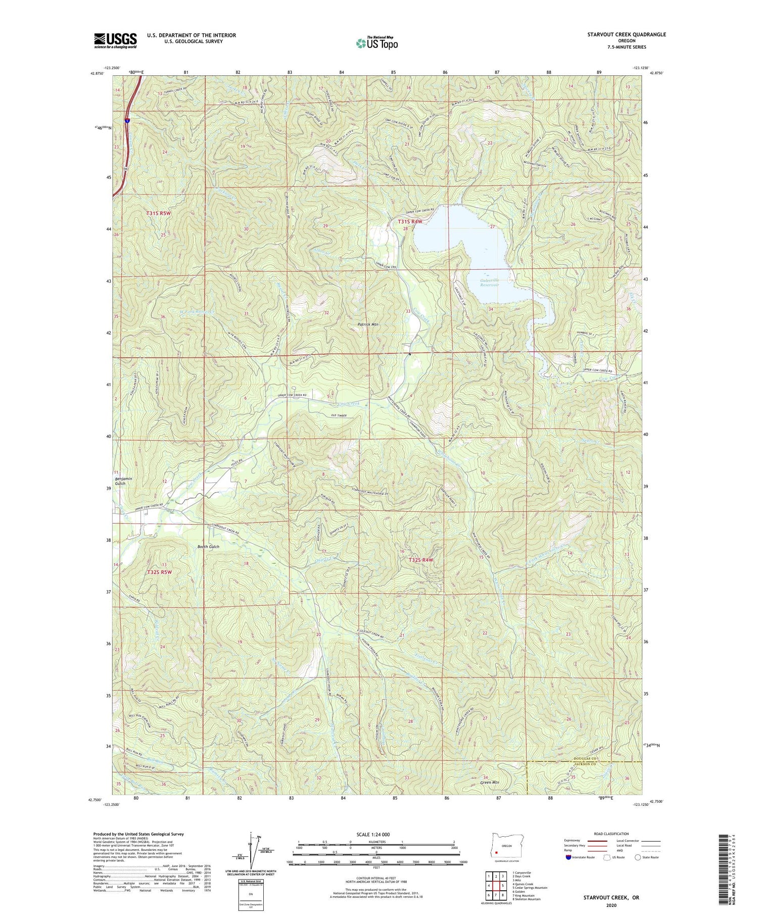
2020 topographic map quadrangle Starvout Creek in the state of Oregon. Scale: 1:24000. Based on the newly updated USGS 7.5' US Topo map series, this map is in the following counties: Douglas, Jackson. The map contains contour data, water features, and other items you are used to seeing on USGS maps, but also has updated roads and other features. This is the next generation of topographic maps. Printed on high-quality waterproof paper with UV fade-resistant inks.
Quads adjacent to this one:
West: Quines Creek
Northwest: Canyonville
North: Days Creek
Northeast: Milo
East: Cedar Springs Mountain
Southeast: Skeleton Mountain
South: King Mountain
Southwest: Golden
Contains the following named places: Albro Creek, Alice Creek, Anchor, Anchor Post Office, Benjamin Gulch, Booth, Booth Gulch, Booth Post Office, Boulder Creek, Chief Miwaleta County Park Boat Ramp, Clear Creek, Dark Creek, East Fork Whitehorse Creek, Fizzleout Creek, Galesvale School, Galesville Dam, Galesville Reservoir, Green Mountain, Hogum Creek, Jones Creek, Long Fibre County Park, McGinnis Creek, Negro Creek, Niday Branch Cow Creek, No Name Creek, Packard Creek, Patrick Mountain, Quartz Creek, Ramsey Creek, Russel Creek, Starvout, Starvout Creek, Starvout Creek Airport, Starvout Post Office, Upper Ramp Galesville Resevior Boat Ramp, West Fork Russel Creek, Whitehorse Creek, ZIP Code: 97410


