MyTopo
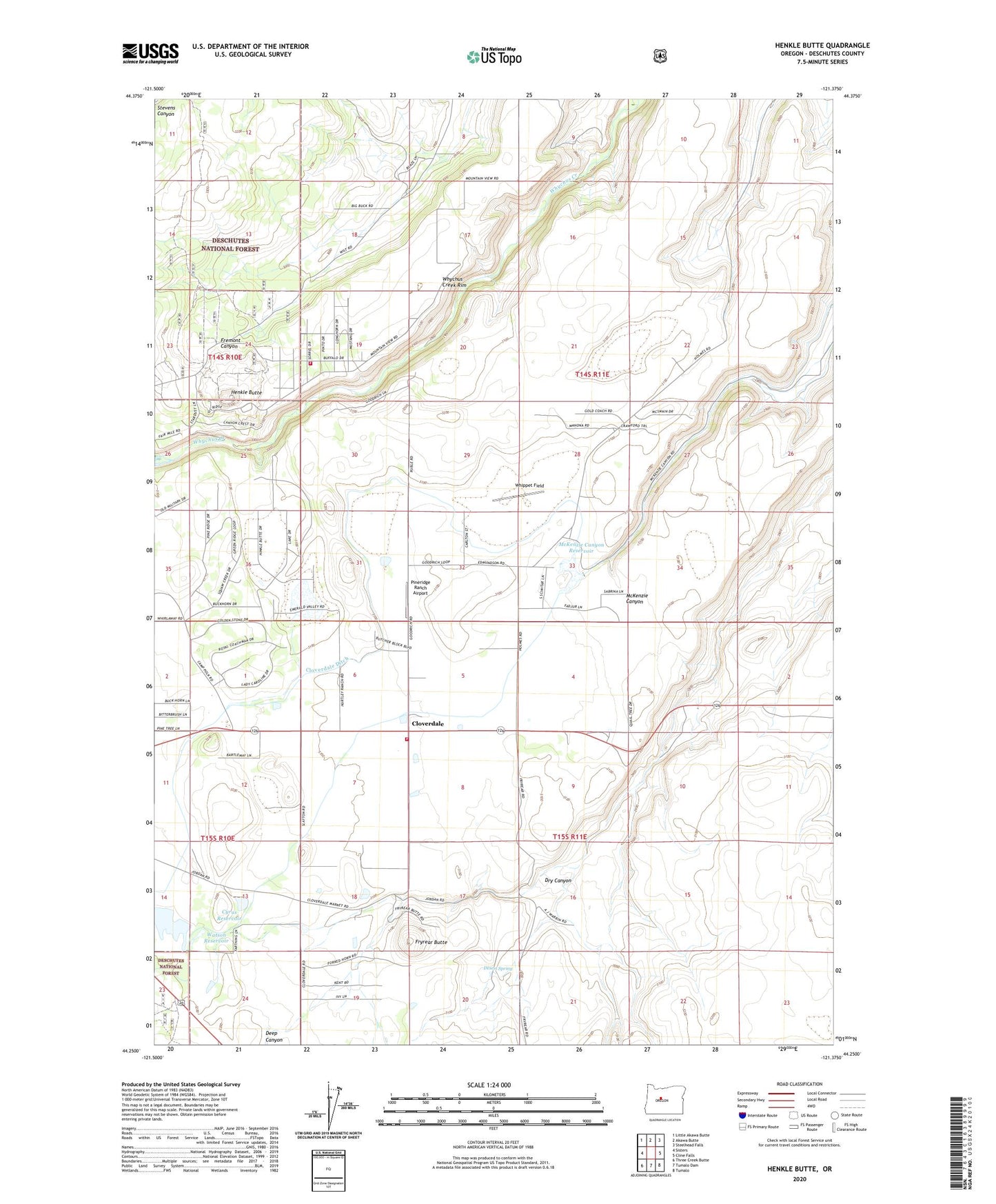
Henkle Butte Oregon US Topo Map
Couldn't load pickup availability
Also explore the Henkle Butte Forest Service Topo of this same quad for updated USFS data
2024 topographic map quadrangle Henkle Butte in the state of Oregon. Scale: 1:24000. Based on the newly updated USGS 7.5' US Topo map series, this map is in the following counties: Deschutes. The map contains contour data, water features, and other items you are used to seeing on USGS maps, but also has updated roads and other features. This is the next generation of topographic maps. Printed on high-quality waterproof paper with UV fade-resistant inks.
Quads adjacent to this one:
West: Sisters
Northwest: Little Akawa Butte
North: Akawa Butte
Northeast: Steelhead Falls
East: Cline Falls
Southeast: Tumalo
South: Tumalo Dam
Southwest: Three Creek Butte
This map covers the same area as the classic USGS quad with code o44121c4.
Contains the following named places: Cloverdale, Cloverdale Ditch, Cloverdale Rural Fire Protection District Station 1, Cyrus Dam, Cyrus Reservoir, Desert Spring, Dry Canyon, Fryrear Butte, Henkle Butte, McKenzie Canyon Dam, McKenzie Canyon Reservoir, Pineridge Ranch Airport, Sisters - Camp Sherman Fire District Station 703 - Squaw Creek Canyon Station, Three Sisters Canal, Three Sisters Irrigation District Dam, Watson Reservoir, Whippet Field, Whychus Creek Rim